
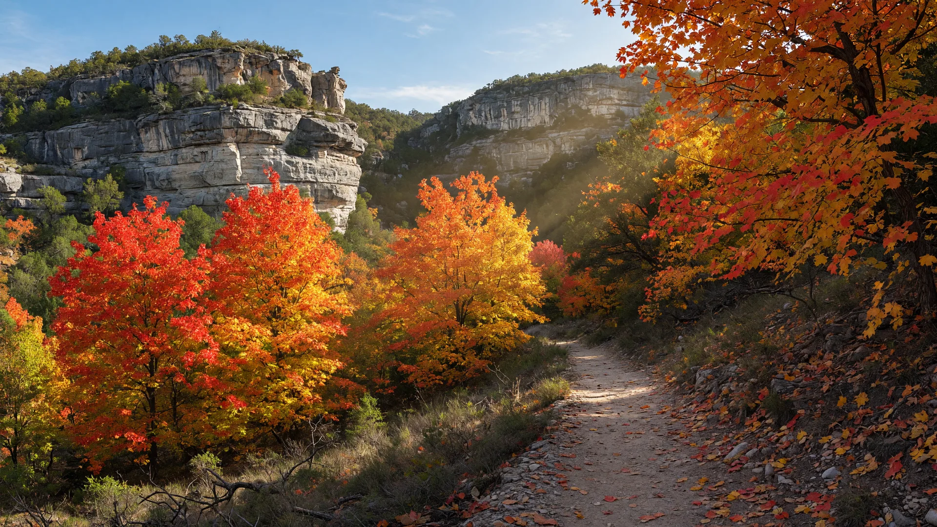
Lost Maples State Natural Area is one of the most compelling outdoor destinations in the Texas Hill Country, and it occupies a unique place in the state park system. Located roughly 70 miles northwest of Boerne near the small community of Vanderpool, this 2,906-acre natural area protects one of the few stands of bigtooth maple trees in Texas — a species more commonly found in the mountains of New Mexico and Arizona [1][2][3]. The park's name comes from the fact that this maple population is a relict from the last Ice Age, surviving in the cool, sheltered canyons of the Sabinal River watershed long after the climate shifted [2][3].
For Hill Country residents and those considering a move to the region, Lost Maples represents something important: the diversity of Texas landscapes. Most people associate the Hill Country with limestone and live oaks. Lost Maples offers deep limestone canyons, cascading spring-fed streams, and a deciduous woodland that transforms into a patchwork of red, orange, and gold each November. Designated a National Natural Landmark in 1980, it is also home to the endangered golden-cheeked warbler and the black-capped vireo — species that nest in the juniper-oak woodlands of the Edwards Plateau [1][2][4].
The park is a 90-minute drive from Boerne, which puts it at the outer edge of an easy day trip. But the journey is part of the experience: the route follows some of the most scenic two-lane roads in the Hill Country, passing through Bandera, the Medina River valley, and the rolling ranchland of Real County. For anyone considering life in the Hill Country, a visit to Lost Maples offers a window into the region's geological and ecological diversity that few other destinations can match.
How to get there from Boerne
Lost Maples State Natural Area is located at 37221 F.M. 187, Vanderpool, TX 78885. From downtown Boerne, the most reliable route heads west on Highway 46 to Bandera (about 25 miles), then continues west on Texas Highway 16 past Medina to the town of Vanderpool. From Vanderpool, the park is roughly five miles north on Ranch Road 187 [1][2].
Total driving distance is approximately 70 miles, with an estimated drive time of 90 minutes under normal conditions. The road from Bandera to Vanderpool is a winding two-lane route through rugged Hill Country terrain with frequent elevation changes, blind curves, and limited passing zones. Drive time increases noticeably if traveling behind slower farm vehicles or during peak fall foliage weekends when traffic to the park can be heavy [1][3].
From Fair Oaks Ranch, add about five miles to the total distance — roughly 75 miles and 95 minutes. From San Antonio, plan on roughly 100 miles and two hours via Highway 16 north through Bandera [1][5]. From Fredericksburg, the most direct route is south on Ranch Road 783 to Highway 27, then west on Highway 39 to Vanderpool — approximately 50 miles and an hour.
The drive from Bandera to Lost Maples along Highway 16 and FM 187 is widely considered one of the most scenic in the Hill Country. The road traces the Medina River corridor, passes through the Sabinal Canyon, and offers long views across the Edwards Plateau escarpment. In fall, the approach to the park is itself a highlight, with roadside maples and sumac providing early color before you even reach the entrance [3][5].
| Starting Point | Distance | Drive Time |
|---|---|---|
| Downtown Boerne | ~70 miles | ~90 min |
| Fair Oaks Ranch | ~75 miles | ~95 min |
| Bandera | ~45 miles | ~60 min |
| San Antonio (I-10 corridor) | ~100 miles | ~115 min |
| Fredericksburg | ~50 miles | ~60 min |
Distances are approximate and based on standard driving routes. Allow extra time during peak fall foliage weekends.
What to see and do
The fall foliage display
The primary draw for most visitors is the autumn foliage display, which typically peaks from mid-to-late November [3][4][6]. The park's bigtooth maples — a subspecies of the Rocky Mountain bigtooth maple (Acer grandidentatum) — turn brilliant shades of red, orange, and yellow in response to shorter daylight and dropping temperatures [2][3]. Because Lost Maples sits at a relatively high elevation (roughly 1,800 to 2,200 feet) in a canyon system that traps cool air, it experiences the most reliable fall color in Texas [2][4].
The Texas Parks and Wildlife Department posts regular foliage reports starting in mid-October each year, allowing visitors to plan around peak color timing [1][4]. The reports describe the percentage of color change and expected peak dates, which can shift by a week or more depending on the year's rainfall and temperature patterns. In drought years, the color may be less intense and the peak window shorter. In wet years with a gradual cooling trend, the display can be spectacular and last two to three weeks [3][4].
Because Lost Maples is a relatively small park in terms of parking capacity — the lot holds roughly 150 vehicles — the park routinely reaches capacity by 8:00 AM on peak fall weekends [1][4][5]. TPWD strongly recommends arriving before 8 AM on Saturdays and Sundays during October and November. Weekday visits offer a much quieter experience with a fraction of the crowds [1][5].
Hiking trails
The park offers over 10 miles of hiking trails across five named routes, ranging from a short interpretive loop to a strenuous canyon-to-rim traverse [1][6][7].
The Maple Trail is a 0.4-mile fully accessible loop that winds through the park's most accessible maple grove. It is paved, relatively flat, and the best option for families with young children, visitors with mobility limitations, or anyone wanting a quick introduction to the park's signature trees without committing to the longer trails [1][7].
The East Trail is a 3.1-mile moderate loop that climbs from the canyon floor to the eastern rim, passing through maple groves, limestone ledges, and a series of scenic overlooks with views across the Sabinal River valley [1][6]. This is the most popular hiking route in the park and offers the best balance of distance, difficulty, and payoff. Allow 90 minutes to two hours for the full loop.
The West Trail is a 2.5-mile moderate-to-strenuous route on the western side of the park. It features the Monkey Rock formation — a weathered limestone outcrop shaped by erosion — and the Grotto, a small recessed cave with seasonal moisture [1][2][6]. The trail is narrower and more rugged than the East Trail, with more exposed sections and steeper grades. Allow 75 to 90 minutes.
The West Loop Trail extends the West Trail into a 3.4-mile loop that reaches the highest points in the park, offering panoramic views of the surrounding ranchland. This trail is strenuous in sections, with significant elevation gain (approximately 450 feet) and uneven limestone steps [1][6]. Allow two to two and a half hours.
The East-West Trail (also called the Connecting Trail) links the East and West trail systems, creating a roughly 5-mile combined loop for hikers who want a full-day experience. This route covers more terrain than any single loop and passes through the deepest part of the canyon system [1][6]. Allow three to four hours for the full combined route.
Birding and wildlife
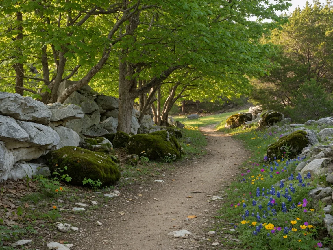
Lost Maples is a designated Important Bird Area and hosts two federally endangered species: the golden-cheeked warbler (which nests exclusively in mature Ashe juniper bark) and the black-capped vireo (which prefers low, scrubby oak thickets) [1][4]. Both species are present from March through July, making spring the best season for dedicated birding. The park also supports turkey vultures, red-tailed hawks, great horned owls, and — in the deeper canyons — the occasional zone-tailed hawk [4].
Birders should bring binoculars and arrive early. The East Trail and the West Trail both pass through suitable warbler and vireo habitat. The park's headquarters area also has feeders that attract lesser goldfinches, painted buntings, and several hummingbird species during migration [4].
Camping
The park offers 30 drive-up campsites (20 with water and electric hookups at $20 per night, plus 10 primitive walk-in sites at $10 per night) and 10 primitive backpack camping sites along the trails [1][5]. The drive-up sites are in a semi-shaded area near the park entrance, with picnic tables, fire rings, and restroom access. The backpack sites require hiking in with your gear and offer a more secluded overnight experience [1][5].
Campsite reservations are handled through the Texas State Parks reservation system and are strongly recommended, particularly during the October-through-November fall foliage season. Sites often book weeks in advance for weekend dates during peak color [1][5].
Picnicking, fishing, and photography
The park has multiple shaded picnic areas near the Sabinal River, with tables and grills available on a first-come, first-served basis [1]. Fishing is allowed with a valid Texas freshwater fishing license, and the river holds sunfish, perch, and the occasional bass [1]. Photography is the third most popular activity after hiking and foliage viewing — the park's limestone cliffs, fall color, and morning light conditions make it one of the most photographed natural areas in Texas [3][4].
Geocaching is also permitted in the park, with several caches hidden along the trail system [1].
Hours, fees, and practical details
| Detail | Information |
|---|---|
| Address | 37221 F.M. 187, Vanderpool, TX 78885 |
| Phone | (830) 966-3413 |
| Park Hours | 8:30 AM – 4:30 PM daily (year-round) |
| Day-Use Fee | $6 per adult (13+), free for children 12 and under |
| Texas State Parks Pass | Covers entry for pass holder and guests |
| Acreage | 2,906 acres (National Natural Landmark) |
| Trail Length | 10+ miles across 5 named trails |
| Camping | 20 electric/water sites ($20/night), 10 primitive walk-in ($10/night), 10 backpack sites |
| Foliage Reports | Published mid-October by TPWD; peak typically mid-to-late November |
| Reservations | Required for camping; day-use is first-come, first-served |
What to bring and practical tips
Arrive early. This is the single most important piece of advice for visiting Lost Maples, particularly during fall foliage season. The parking lot holds roughly 150 vehicles and routinely fills before 8:00 AM on weekends in October and November [1][4][5]. The park gates open at 8:30 AM, but cars often begin lining up outside the entrance by 7:30 AM during peak weekends. Midweek visits are significantly less crowded.
Cell service is essentially nonexistent in and around the park. The canyon walls block most signals. Download offline maps of the area before leaving Boerne or Bandera, and save the park's foliage report page before you lose reception [1][5]. Free WiFi is available at park headquarters, but the connection is limited and should not be relied on for navigation [1].
Water and food. Bring at least one liter of water per person for hiking. The park has no food concessions or drinking fountains, and the nearest restaurants are in Vanderpool (very limited options) or back in Bandera (45 minutes east) [1][5]. Pack a lunch, snacks, and plenty of water. Coolers are welcome at the picnic areas.
Footwear. The trails are a mix of packed limestone, exposed rock, and uneven steps. Sturdy hiking shoes or trail runners with good traction are strongly recommended. Trail runners in particular are popular for the East Trail because they provide enough support for the rocky sections while staying light for the climbs [1][6][7]. Sandals and casual sneakers are not suitable for any trail beyond the 0.4-mile Maple Trail.
Photography gear. For fall color photography, a polarizing filter helps cut glare from the limestone and saturate the maple foliage. A standard zoom lens (24–70mm or similar) covers most scenarios. A tripod is useful for canyon shots in low morning light. The best light is typically between 8:30 AM and 10:30 AM, when the sun angles into the canyon from the east [3][4].
Layered clothing. Morning temperatures in the canyons can be 20 degrees cooler than the surrounding plateau, even when the afternoon is warm. A fleece or light jacket in spring and fall, and a heavier coat in winter, is advisable [1][5].
Pets. Pets on leashes (6 feet or shorter) are allowed on trails and in the campground but not on the Maple Trail or in park buildings [1].
Seasonal timing: when to go
| Season | What to Expect | Notes |
|---|---|---|
| Spring Mar – May | Birding peak, wildflowers, moderate hiking temperatures | Best time for golden-cheeked warbler and black-capped vireo sightings. Wildflowers along trails. Mild, pleasant hiking weather. |
| Summer Jun – Aug | Hot and humid, fewer crowds, early morning hiking | Canyons stay 5–10 degrees cooler than the plateau. Start hikes by 8:30 AM. Bring extra water. Swimming in the Sabinal River at your own risk. |
| Fall Oct – Nov | Peak foliage season, busiest time of year | Foliage reports from mid-October. Peak color mid-to-late November. Arrive before 8 AM on weekends. Weekdays recommended for a quieter experience. |
| Winter Dec – Feb | Bare trees, solitude, cold canyon mornings | Least crowded season. Trails are quieter but can be muddy. No foliage color but excellent views of canyon geology and rock formations. |
Why it matters if you are considering the Hill Country
Lost Maples tells a story about the Hill Country that cannot be found in a subdivision brochure or a school district ranking. The presence of a relict Ice Age forest in this specific location — at this elevation, in these limestone canyons — is a concrete illustration of the region's ecological and geological complexity [2][3][4]. For anyone evaluating a move to the Hill Country, understanding that complexity matters.
The same limestone that forms the park's canyons — the Glen Rose Formation — underlies much of the Edwards Aquifer recharge zone across Kendall, Bandera, and Real Counties [2][4]. When a property sits on this formation, the well depth, water quality, and septic system design are all influenced by the same geology that created Lost Maples' cliffs and caves. A visit to the park is not just a scenic outing; it is a tangible introduction to the physical landscape that governs so many practical aspects of Hill Country living [2][5].
The fall foliage display itself is a seasonal reminder of why this region attracts people from across the country. The Hill Country is not a flat, uniform landscape. It has elevation, microclimates, and seasonal variation that produce real ecological richness. Places like Lost Maples demonstrate that depth. For relocating families, particularly those coming from regions with pronounced autumn seasons, a November visit to Lost Maples can answer a question that no school score or market statistic can: does this place have the seasonal beauty and natural character I am looking for?
There is also a practical dimension. The park's popularity creates a natural supply-and-demand dynamic: the limited parking and camping capacity mean that fall visits require real planning. This is a characteristic that carries over into Hill Country life more broadly. Popular destinations, good schools, quality contractors, and desirable properties all require advance planning here. A visit to Lost Maples during peak season is a useful test of how comfortable you are with the trade-offs that come with living in a highly desirable but capacity-constrained region [4][5].
For a combined day trip, Lost Maples pairs naturally with a morning or afternoon in Bandera (25 miles southeast), the Cowboy Capital of the World. The route from Bandera to the park along Highway 16 is one of the most scenic drives in the Hill Country, making it easy to visit both destinations in a single day. Alternatively, the drive from Fredericksburg to Lost Maples via Highway 39 passes through the historic towns of Harper and Doss, offering a pleasant loop through the northern Hill Country that can be paired with a stop at the LBJ State Park and Ranch [3][5].
Frequently asked questions
How far is Lost Maples State Natural Area from Boerne?
Approximately 70 miles northwest of downtown Boerne via Highway 46 and Highway 16 through Bandera. The drive takes roughly 90 minutes under normal conditions [1][2][3].
When is the best time to see fall colors at Lost Maples?
Peak fall foliage typically occurs from mid-to-late November. The Texas Parks and Wildlife Department publishes weekly foliage reports starting in mid-October to track color progression. The timing varies by several weeks depending on the year's rainfall and temperature patterns [1][3][4].
How much does it cost to visit Lost Maples State Natural Area?
Day-use entry is $6 per adult (ages 13 and older) and free for children 12 and under. An annual Texas State Parks Pass covers entry for the pass holder and accompanying guests. Camping fees are extra — $20 per night for electric/water sites and $10 per night for primitive walk-in sites [1][5].
Do I need a reservation to visit Lost Maples?
Day-use visits are first-come, first-served — no reservation is needed. However, the parking lot frequently reaches capacity by 8:00 AM on fall weekends. Camping reservations are strongly recommended and can be made through the Texas State Parks reservation system [1][5].
Is there cell service at Lost Maples?
No. Cell service is essentially nonexistent in and around the park due to the canyon walls. Free WiFi is available at park headquarters but is limited. Download offline maps and any information you may need before leaving Bandera or Boerne [1][5].
Sources
- [1] Texas Parks and Wildlife Department — Lost Maples State Natural Area. tpwd.texas.gov/state-parks/lost-maples
- [2] Wikipedia — Lost Maples State Natural Area. en.wikipedia.org/wiki/Lost_Maples_State_Natural_Area
- [3] Incredible Texas — Lost Maples State Natural Area: Map, Hours, Camping, Trails, and Fall Foliage. incredibletexas.com
- [4] Traveler Life — Ultimate Guide to Lost Maples State Natural Area. travelerlifes.com
- [5] America's State Parks — Lost Maples State Natural Area. americasstateparks.org
- [6] Texas Parks and Wildlife Department — Lost Maples State Natural Area: Trails Info. tpwd.texas.gov/state-parks/lost-maples/trails-Info
- [7] AllTrails — Best Trails in Lost Maples State Natural Area. alltrails.com
Published August 27, 2026
Updated August 27, 2026