
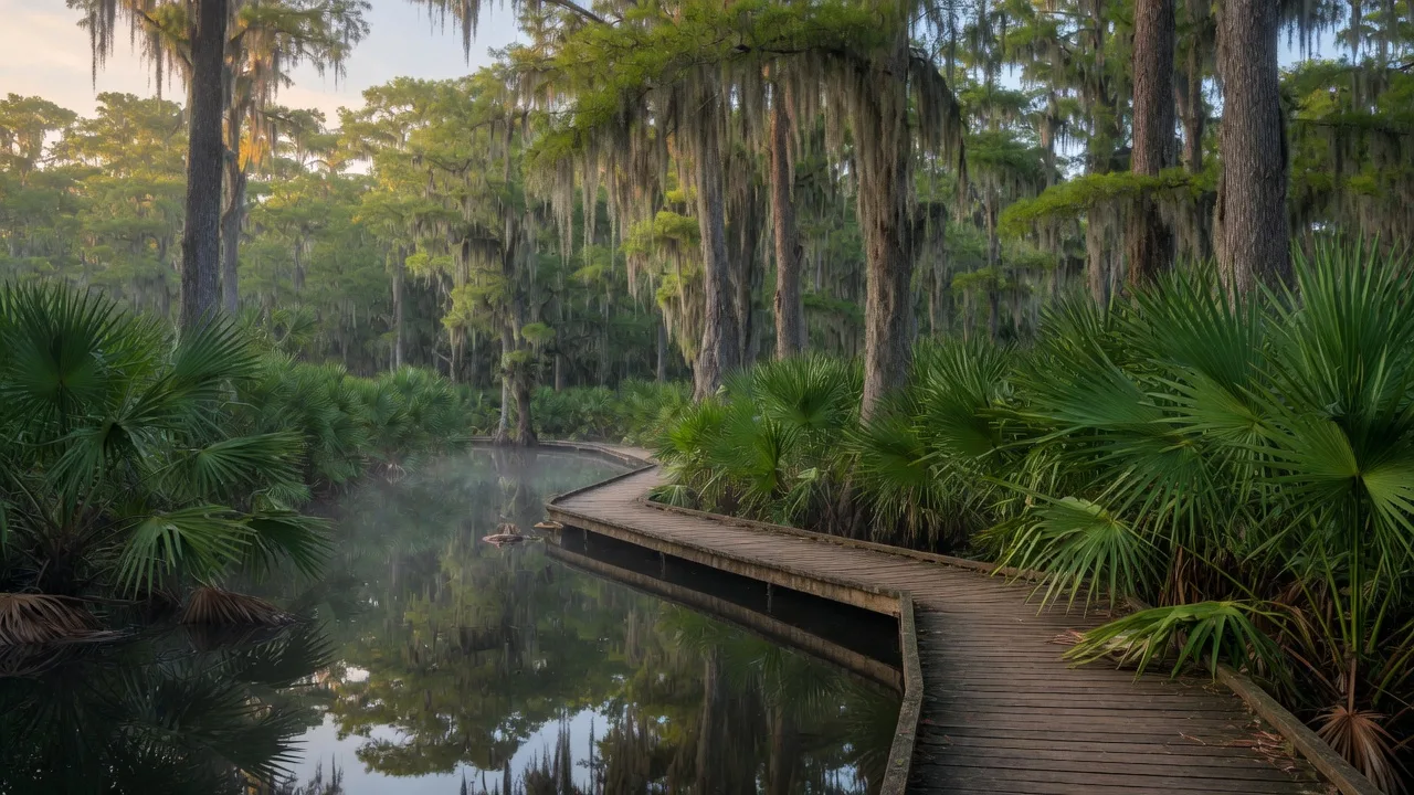
Palmetto State Park is a surprise even to people who have lived in Texas their whole lives. It is a small, 270-acre park in Gonzales County, set off U.S. Highway 183 midway between the towns of Luling and Gonzales [1][2]. Instead of the open, drought-tolerant landscape most people picture in the Hill Country, it is a dense, subtropical swamp dominated by the dwarf palmetto (Sabal minor) and towering bald cypress, a pocket of vegetation that feels more like Louisiana than Central Texas [1][4]. It is frequently described as the only palmetto swamp in the American Southwest [1][2].
The park hugs the spring-fed San Marcos River and also holds a small 4-acre oxbow lake, giving it water on two fronts and an unusually rich habitat for its size [1][4]. Birders have recorded more than 240 species here, and the mix of cypress groves, marsh, and river channel makes it a magnet for wildlife [1]. For a day trip from Boerne, Palmetto is a roughly hour-and-a-half to two-hour drive southeast, and it delivers something no other Hill Country park does: a genuinely swampy, green, water-rich corner of Texas that rewrites the usual expectations of the region.
This guide covers the best routes from Boerne, what to see and do, hours and fees, seasonal timing, and why this odd, green little park is relevant to anyone weighing a move to the Hill Country.
How to get there from Boerne
Palmetto State Park is located at 78 Park Road 11 S, Gonzales, TX 78629. The park entrance sits off U.S. Highway 183, roughly midway between Luling (about 6 miles northwest) and Gonzales (about 10 miles southeast), and is reached by a short drive down Park Road 11 [1][2][3].
From downtown Boerne, the most direct route heads east on Interstate 10 toward San Antonio and Seguin, connects onto U.S. 183 near Luling, and then turns southwest on Park Road 11 for the final stretch into the park [8]. The full drive is roughly 95 to 100 miles and typically runs about an hour and a half to an hour and forty minutes under normal traffic [8]. Drivers coming from the south can approach from Gonzales, heading northwest on U.S. 183 to the park turnoff.
The approach is mostly four-lane and freeway until you leave the I-10 corridor, then two-lane ranch country for the last stretch into the park. There is no reliable fuel on the final leg, so fill up in San Antonio, Seguin, or Luling before you head off the main highway. On busy weekends the small day-use lot can fill, so arriving by mid-morning is the reliable play [1].
| Starting Point | Distance | Drive Time |
|---|---|---|
| Downtown Boerne | ~95-100 miles | ~90-100 min |
| San Antonio | ~75 miles | ~70 min |
| Luling | ~8 miles | ~15 min |
| Gonzales | ~10 miles | ~20 min |
| Lockhart | ~40 miles | ~50 min |
Distances are approximate and based on standard driving routes. Allow extra time on holiday weekends when the park can reach capacity.
What to see and do
Walk the swamp and the Ottine marsh
The reason to come is the vegetation. The park protects a stand of dwarf palmettos, a low, fan-leafed plant that grows at the northern edge of its range here, and the effect is a wall of green unlike anything else in the region [1][2]. The Ottine Swamp and the area around the oxbow lake are the heart of it, with cypress knees rising out of dark, still water and Spanish moss hanging from the branches. It reads as exotic because it is: this is a wet, subtropical habitat that survives only where springs keep the ground saturated [1][4].
Follow the easy, flat trails
Palmetto is a walker's park in the best sense. The main hiking routes, including the San Marcos River Trail, the Mesquite Flats Trail, and the Ottine Swamp Trail, are short, flat, and gravel, making them accessible for families, older visitors, and anyone who wants a leisurely wander rather than a workout [1][2]. The trails thread between the river, the oxbow lake, and the swamp, so a couple of hours covers a surprising amount of the park's variety. A fishing pier over the oxbow lake is a quiet spot to stop and take in the water [1].
Swim, paddle, and fish the San Marcos River
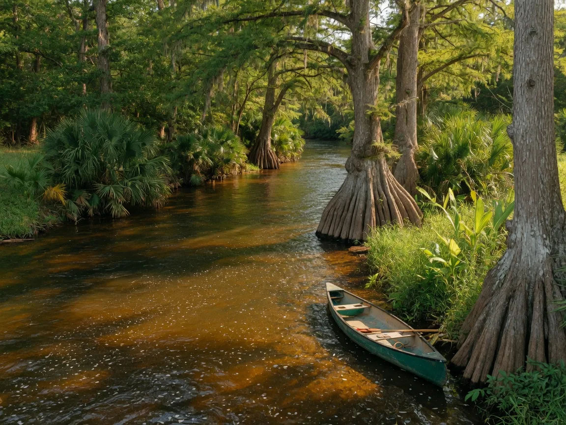
The San Marcos River runs clear and spring-fed along the park's edge, and it is the place to get in the water. There are swimming areas along the river, and paddlers and tubers can launch a kayak, canoe, or tube from the park, though visitors need to bring their own watercraft because the park no longer rents them [1]. The river here is gentler and less crowded than the more famous tubing runs farther upstream, which makes it a relaxed option for a first paddle. Fishing the warm water is popular, and the oxbow lake has its own pier for anglers [1].
See the artesian well and the CCC-era stonework
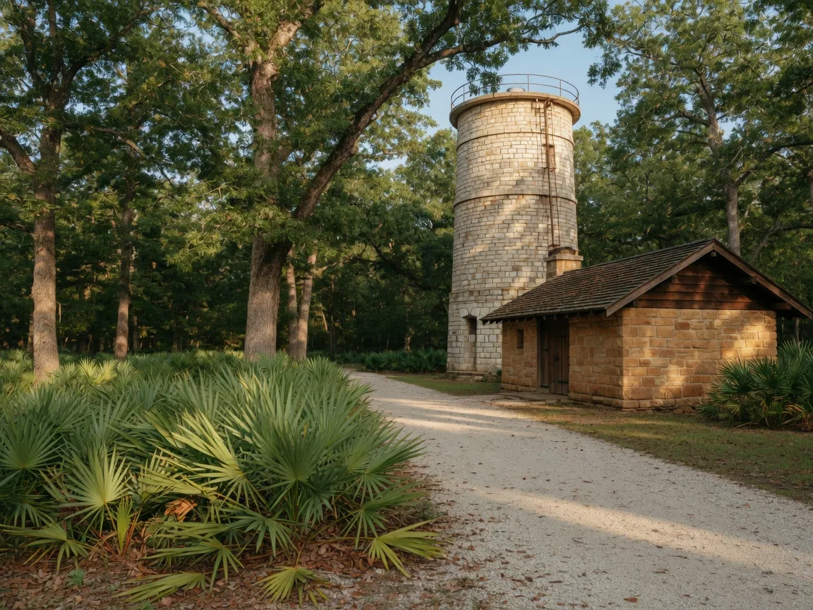
Buried in the park's history is a genuinely strange piece of geology. An artesian well was discovered here in 1909, reportedly drilled to about 1,554 feet and bringing up water around 107 degrees Fahrenheit, and the site once featured geothermal mud boils that bubbled warm water and mud from the ground [4]. The mud boils stopped functioning in the 1970s, but the Civilian Conservation Corps built a stone structure, a sort of simulated mud boil, over the well in the 1930s that still stands as a landmark [4]. The same CCC crews, working from 1934 to 1937, built the park road, low-water crossing, headquarters, refectory, entrance structures, and a water tower powered by a hydraulic ram pump, and much of that sandstone architecture remains in use today [4]. It is a compact, walkable slice of both natural and built history.
Camp, picnic, and watch the birds
Palmetto is a favorite for a low-key overnight. It offers 37 single-family campsites, 17 with water and electric hookups plus one full-hookup site, along with showers, a sewage dump, and a group shelter [1][3]. The birding is excellent year-round, and because the park is small and mostly flat, it is an easy place to settle into a picnic table under the cypress and let an afternoon drift by [1][7].
Hours, fees, and practical details
| Detail | Information |
|---|---|
| Day entry (13 and older) | $3 per person; 12 and under free; Texas State Parks Pass waives the fee [1] |
| Open hours | Daily, generally 6 a.m. to 10 p.m.; gate may close if flooded [1][5] |
| Campsite with water | $12 per night plus entrance fee [3] |
| Campsite with electric | $18 per night plus entrance fee [3] |
| Cabin | $55-$65 per night plus entrance fee [3] |
| Reservations | Online up to 12 months ahead, or by phone at (512) 389-8900 [3] |
Fees and rates are set by Texas Parks and Wildlife and can change; check the park homepage before your visit. The park may close on select dates for permitted hunting.
Because the park is small, TPWD recommends reserving day passes and campsites in advance, and the park frequently reaches capacity on nice weekends [1]. Plan around the handful of dates each year when the park closes for permitted hunting, and check the homepage for flood notices after heavy rain, since the low-lying river crossings can go underwater [1][3].
Best time to visit and seasonal planning
| Season | What it is like | Best for |
|---|---|---|
| Spring (Mar-May) | Lush greenery, migrating songbirds, mild days; river cool | Birding, swamp walks, photography |
| Summer | Hot and humid, but the swamp canopy stays shaded; reserve ahead | Swimming, paddling, camping |
| Fall (Sep-Nov) | Milder, quieter, cypress begin to turn; good river levels if rains arrive | Hiking, fishing, low-crowd visits |
| Winter (Dec-Feb) | Cold water, bare cypress, quiet park; check hunting-closure dates | Solitude, winter birding |
Spring and fall are the sweet spot for most visitors, when the swamp is at its greenest and the temperatures are mild enough to enjoy the trails without sweating. Summer is fully open for swimming and paddling, and the dense canopy keeps the trails surprisingly shaded, but the humidity is real and the park fills up on weekends. Winter is quiet and contemplative, best for a cold-weather wander and winter birding, with the caveat of checking the occasional hunting-closure date [1][3].
Practical tips for the day
Bring your own watercraft if you want to paddle or tube. The park no longer rents kayaks, canoes, or tubes, so anything you want to float must come with you [1]. For a day trip, that means a kayak on a roof rack or a plan to just swim from the bank.
Pack a lunch and plenty of water. There is no full-service restaurant in the park, and the surrounding towns, while close, are small. The shaded picnic areas under the cypress are ideal, and a cooler is the most reliable plan [1].
Bring insect repellent. This is a real swamp, and the mosquitoes can be active, especially near the water in the warmer months. Repellent and long sleeves make the difference between a pleasant wander and an uncomfortable one [7].
Reserve ahead on weekends. The park is small, and the camping and day-use capacity fills on nice days. Booking a day pass or campsite online well in advance avoids a closed gate and a wasted drive [1][3].
Check flood and hunting notices. The low-lying river crossings can flood after heavy rain, and the park closes on select hunting dates, so a quick check of the TPWD homepage before you leave is worth the thirty seconds [1][3].
Why it matters if you are considering the Hill Country
Palmetto matters to anyone weighing a move to the Hill Country for a reason that cuts against the usual stereotype. The dominant story of this region is dry: limestone, thin soil, water scarcity, and the Edwards Aquifer. Palmetto is the counterexample that lives right at the edge of that story, a reminder that where water rises to the surface, the Hill Country can look like a subtropical jungle. The dwarf palmettos and cypress only exist because of a steady supply of spring water, and seeing that juxtaposition in person is a useful, grounded way to understand the role that groundwater and springs play across the whole region [1][4].
Second, Palmetto is a lesson in the value of the state park system as a practical amenity. At three dollars a person, it is one of the cheapest and most distinctive outdoor options near the I-10 corridor between San Antonio and Houston [1]. For a family deciding whether the Hill Country gives them enough to do, the ability to drive an hour and a half to a place this different, with easy trails and a spring-fed river, is a real quality-of-life asset that is easy to underestimate from a distance.
And third, the park is a natural pairing with the small-town identity of the area. It sits between Luling and Gonzales, two towns that anchor the barbecue and small-town character of this corner of Texas, so it turns naturally into a full day: a morning in the swamp, an afternoon wandering the towns, and dinner at one of the legendary pits nearby. It is the kind of day that shows how much texture exists just beyond the well-known Hill Country destinations, and how a short drive from Boerne can open up an entirely different landscape.
For a combined itinerary, pair Palmetto with a barbecue day through Luling, just eight miles up U.S. 183, or extend to Lockhart, the state's famous barbecue town about 40 miles away. Both are Historic Towns guides that round out the day with food and small-town character to match the park's quiet green.
Frequently asked questions
How far is Palmetto State Park from Boerne?
Roughly 95 to 100 miles southeast of downtown Boerne, about an hour and a half to an hour and forty minutes, via Interstate 10 east and U.S. 183 near Luling [8].
How much does it cost to enter Palmetto State Park?
Day entry is $3 per person ages 13 and older, free for ages 12 and under, and free with a Texas State Parks Pass. Camping is separate, starting around $12 to $18 per night for sites [1][3].
Is Palmetto State Park good for swimming?
Yes. There are swimming areas along the San Marcos River, and you can also paddle or tube if you bring your own watercraft, since the park no longer rents them [1].
Do I need a reservation to visit Palmetto State Park?
TPWD recommends reserving day passes and campsites in advance, and the small park often reaches capacity on nice weekends. Reservations can be made up to 12 months ahead [1][3].
What makes Palmetto State Park unique?
It protects the only palmetto swamp in the American Southwest, a subtropical habitat of dwarf palmettos and bald cypress on the San Marcos River that feels more like Louisiana than Central Texas [1][2][4].
Sources
- [1] Texas Parks and Wildlife Department, Palmetto State Park. tpwd.texas.gov/state-parks/palmetto
- [2] Texas Parks and Wildlife Department, Palmetto State Park Map. tpwd.texas.gov/state-parks/palmetto/map
- [3] Texas Parks and Wildlife Department, Palmetto State Park Campsites. tpwd.texas.gov/state-parks/palmetto/fees-facilities/campsites
- [4] Wikipedia, Palmetto State Park. en.wikipedia.org/wiki/Palmetto_State_Park
- [5] Texas State Historical Association, Palmetto State Park. tshaonline.org/handbook/entries/palmetto-state-park
- [6] Texas State Historical Association, Ottine Swamp Designated State Park. tshaonline.org/texas-day-by-day/entry/251
- [7] Texas Master Naturalist Lost Pines, Back Roads Nature: Palmetto State Park. txmn.org/lostpines
- [8] Trippy, Driving Distance from Boerne to Gonzales. trippy.com/distance/Boerne-to-Gonzales-TX
Published September 21, 2026
Updated September 21, 2026