
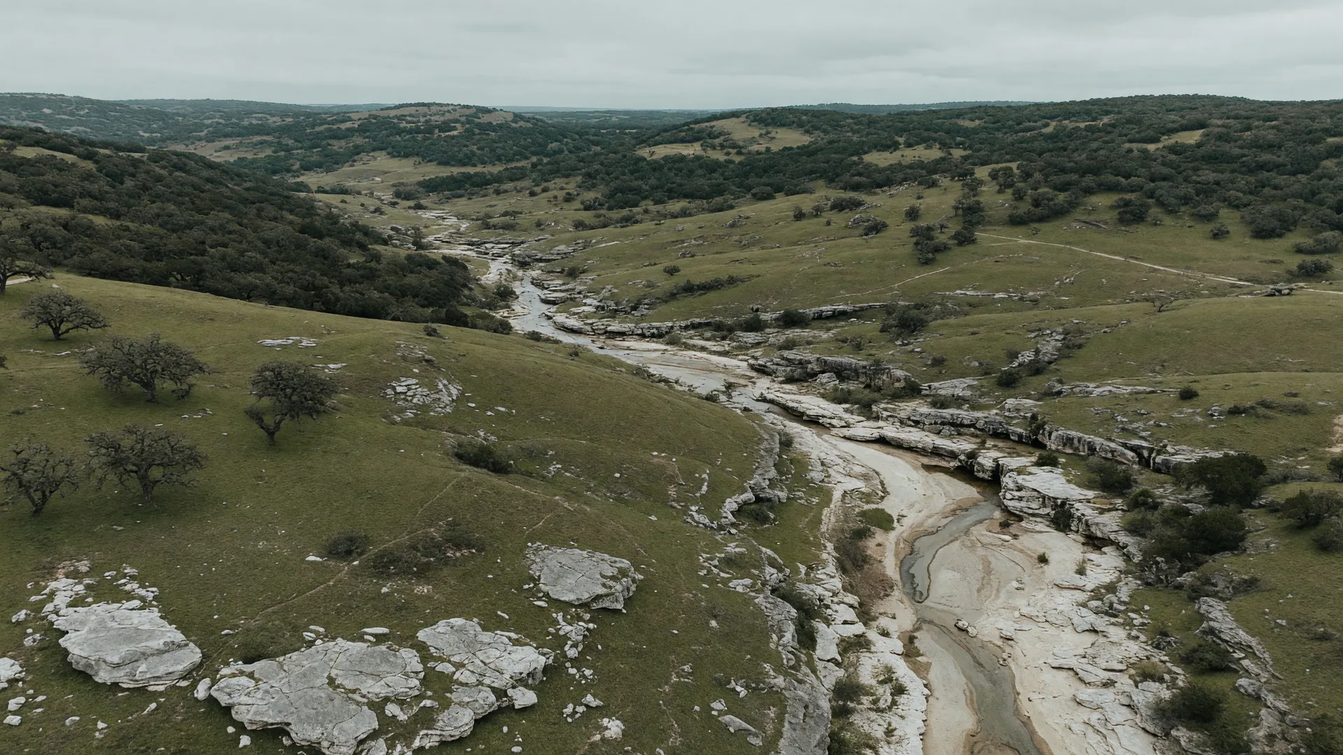
Home buyers and sellers in the Texas Hill Country routinely encounter flood zone designations during due diligence — and routinely misunderstand what those designations actually mean. A property listed as “Zone AE” triggers mandatory flood insurance, adds hundreds or thousands of dollars in annual carrying costs, and can complicate a transaction. A property in “Zone X” may seem safe from flood risk, but Zone X does not mean zero risk — it means the property is outside the 100-year floodplain on a map that may not capture flash flood behavior, karst drainage patterns, or recent development-driven changes to stormwater runoff. The Hill Country sits inside “Flash Flood Alley,” the most flash-flood-prone region in the United States, and its limestone geology creates flooding dynamics that FEMA’s zone maps do not always reflect [1][2]. Here is how the system actually works, what the zones mean, and what buyers and sellers in Boerne, Fair Oaks Ranch, and San Antonio need to verify before a transaction closes.
How FEMA flood zones actually work
FEMA assigns flood zone designations through the National Flood Insurance Program (NFIP) mapping process. The maps are called Flood Insurance Rate Maps (FIRMs), and they define areas based on the statistical probability of flooding — not the actual observed flood behavior at a specific property. The most relevant zones for Hill Country buyers and sellers are [3]:
FEMA Flood Zones: What They Actually Mean
| Zone | Definition | Insurance Required? |
|---|---|---|
| Zone AE | Special Flood Hazard Area (SFHA). 1% annual chance of flooding (the “100-year floodplain”). Base Flood Elevations (BFEs) are determined. | Yes — mandatory for federally backed mortgages |
| Zone AH | SFHA with shallow flooding (1–3 feet) from ponding. Typically in low-lying areas with poor drainage. | Yes — mandatory for federally backed mortgages |
| Zone X (Shaded) | Moderate flood risk. 0.2% annual chance (the “500-year floodplain”). Outside the 100-year floodplain but within the 500-year. | Not mandatory, but recommended |
| Zone X (Unshaded) | Minimal flood hazard. Less than 0.2% annual chance of flooding. | Not mandatory |
| Zone D | Undetermined risk. FEMA has not conducted a flood study for this area. | Not mandatory, but risk is unknown |
Source: FEMA National Flood Insurance Program; FEMA Flood Map Service Center. Zones are defined by FEMA FIRM panels, not by observed flood history at a specific property.
The critical distinction: Zone AE means mandatory flood insurance. Zone X does not. For buyers using a federally backed mortgage (conventional, FHA, VA, or USDA), a property in Zone AE requires a flood insurance policy through the NFIP or a qualifying private insurer as a condition of loan approval. This is not optional — the lender is required to enforce it [3][4]. For cash buyers or those using non-federally-backed financing, flood insurance is technically optional even in Zone AE, though skipping it is a significant financial risk.
For Zone X properties, flood insurance is not required by the lender but is available for purchase. Many Hill Country buyers in Zone X choose to carry a policy anyway, because the zone designation does not account for the region’s specific flash flood dynamics [1].
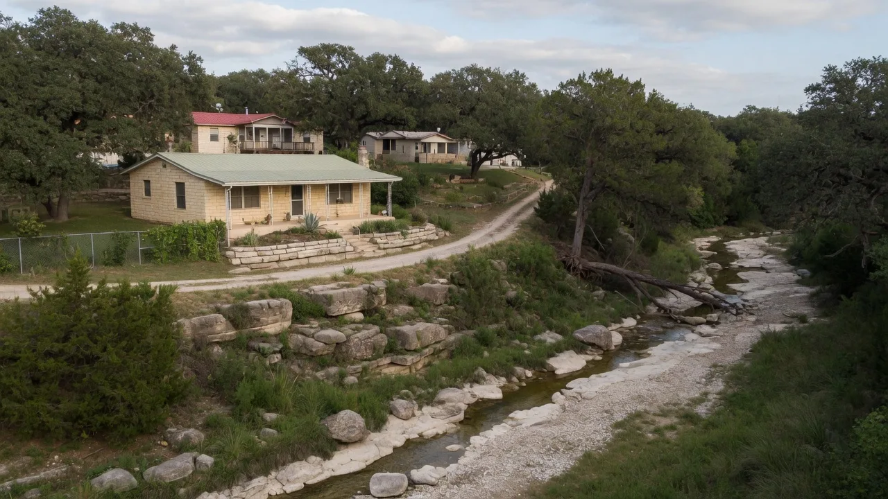
Why the Hill Country is different: Flash Flood Alley and karst geology
The Texas Hill Country is not a typical flood-risk region. It sits inside “Flash Flood Alley,” a 300-mile corridor from Austin to San Antonio that is recognized as the most flash-flood-prone area in North America [1][2]. The combination of factors that creates this risk is specific to the region:
- Karst limestone geology. The Hill Country is built on fractured limestone with thin topsoil. Rainwater cannot absorb into the ground the way it does in areas with deep, permeable soil. Instead, it runs across the surface rapidly, collecting in creek beds and drainages with very little lag time between rainfall and peak flow [2].
- Steep terrain and narrow valleys. The rolling hills and narrow creek valleys of Kendall and Comal Counties funnel runoff into concentrated channels. Cibolo Creek, the Guadalupe River, and their tributaries can go from dry to bank-full in hours [1].
- Variable rainfall intensity. Central Texas receives some of the highest peak rainfall intensities in the continental United States. Storm systems can deliver 3 to 8 inches of rain in a single hour over a localized area [2].
- Underground drainage through karst conduits. Water in the Hill Country does not only flow on the surface. It travels through underground limestone conduits, sinkholes, and caves — meaning flooding can occur in areas that appear geographically distant from any visible waterway [2].
The practical effect: FEMA flood maps are based on modeled floodplains along visible waterways. They do not fully capture overland flash flooding, karst-driven subsurface drainage, or the effects of upstream development on downstream runoff patterns. Properties that FEMA classifies as Zone X (minimal risk) have experienced flooding in the Hill Country — and will again [1].
Kendall County and Fair Oaks Ranch: what the current maps show
The current FEMA Flood Insurance Rate Map (FIRM) for Kendall County has an effective date of December 17, 2010 [5]. That is a 16-year-old map. FEMA released preliminary updated flood maps for Kendall County (along with Bandera, Bexar, Kerr, and Medina Counties) for public review in January 2025 [6]. Until those maps are adopted and become effective, the 2010 panels govern flood zone designations, insurance requirements, and lending decisions.
Key flood zone details for the area [5][7]:
Flood Zone Overview: Boerne, Fair Oaks Ranch & Kendall County
| Area | Primary Flood Zones | Key Waterways | NFIP Status |
|---|---|---|---|
| Boerne (within city limits) | Zone AE along Cibolo Creek; Zone X in most surrounding areas | Cibolo Creek, Boerne Lake | Participating community |
| Fair Oaks Ranch | Zone AE along Guadalupe River and tributaries; Zone X in most residential areas | Guadalupe River, scattered tributaries | Participating community (Community ID 481644) |
| Unincorporated Kendall County | Zone AE along river corridors; Zone X on higher ground | Guadalupe River, Cibolo Creek, various unnamed drainages | Participating community |
| NW San Antonio corridor | Zone AE along Leon Creek, Helotes Creek; Zone X in most neighborhoods | Leon Creek, Helotes Creek, Medina River tributaries | Participating community |
Source: FEMA Flood Insurance Rate Map, Kendall County (effective 12/17/2010); Fair Oaks Ranch Floodplain Management; City of Boerne Floodplain Management. Zone designations are property-specific and depend on exact location relative to mapped floodplains.
Neither Boerne nor Fair Oaks Ranch is entirely within or outside a flood zone. The zone designation varies by individual property — even within the same subdivision. A home 200 feet from Cibolo Creek may be Zone AE while a home 800 feet away is Zone X. The only way to confirm a property’s specific zone is to check the FEMA FIRM panel for that exact parcel [5].
What flood insurance actually costs under Risk Rating 2.0
FEMA overhauled how it prices flood insurance on October 1, 2021, with the implementation of Risk Rating 2.0 — the first major methodology change since the NFIP was created in 1968 [8]. The new system replaces zone-based pricing with property-specific risk analysis. The result is that two homes in the same Zone AE can have dramatically different premiums based on their individual characteristics.
Risk Rating 2.0 uses these factors to calculate premiums [8][9]:
- Distance to water source — proximity to rivers, streams, creeks, and other water bodies. Closer properties pay more.
- Flood frequency — how often flooding has occurred historically in the area.
- Type of flood source — whether the property is exposed to river overflow, rainfall/runoff, storm surge, or other mechanisms.
- Foundation type — slab-on-grade, crawlspace, elevated, or basement. Elevated foundations receive lower premiums.
- First-floor height — the height of the lowest living floor above adjacent grade, relative to Base Flood Elevation.
- Replacement cost value — the full cost to rebuild the structure.
For Texas properties, the premium distribution under Risk Rating 2.0 is wide [8][9][10]:
NFIP Flood Insurance Cost Estimates: Hill Country Properties
| Property Scenario | Estimated Annual Premium | Monthly Cost |
|---|---|---|
| Zone X, no flood history | $400 – $650 | $33 – $54 |
| Zone AE, elevated foundation, well above BFE | $700 – $1,500 | $58 – $125 |
| Zone AE, slab-on-grade, near BFE | $1,800 – $4,000 | $150 – $333 |
| Zone AE, slab-on-grade, below BFE | $4,000 – $8,000+ | $333 – $667+ |
| NFIP maximum premium (single family) | $12,125 | $1,010 |
Sources: NFIP Risk Rating 2.0 methodology; FEMA; Insurify; Hippo; ValuePenguin. Texas statewide average NFIP premium is approximately $522 to $912 annually, but Zone AE premiums are significantly higher. Actual premiums depend on property-specific factors. Annual premium increases are capped at 18% per year until the full-risk rate is reached.
Under Risk Rating 2.0, approximately 80% of Texas NFIP policyholders will see premium increases over time [8]. The maximum annual premium for a single-family home is capped at $12,125. For buyers, this means the flood insurance cost for a property in Zone AE is not a fixed line item — it depends on the foundation type, elevation, distance to the waterway, and replacement cost of the home [8][9].
For buyers in Zone X (minimal risk), flood insurance is not lender-required but is available. A Zone X policy for a $450,000 Hill Country home typically costs $400 to $650 per year — roughly $33 to $54 per month. Given the Hill Country’s flash flood history, this is often worth the cost [1][10].
What Zone X does not mean
The most dangerous assumption a buyer can make is that Zone X equals “no flood risk.” Zone X means the property is outside the mapped 100-year and 500-year floodplains on the current FIRM. It does not mean the property has never flooded, will never flood, or is immune to the specific flooding dynamics of the Hill Country [1].
Several factors make Zone X designations less reliable in this region:
- Overland flash flooding. FEMA maps model river and creek floodplains. They do not model overland sheet flow during extreme rainfall events. In the Hill Country, 4 to 6 inches of rain in one hour can overwhelm surface drainage systems and cause water to flow across roads, driveways, and properties that are nowhere near a mapped waterway [1][2].
- Outdated maps. The Kendall County FIRM was last updated in 2010 [5]. Upstream development, land clearing, road construction, and changes in drainage patterns since 2010 can alter where water flows during extreme events. The maps have not been revised to account for these changes.
- Karst subsurface drainage. Water traveling through underground limestone conduits can emerge in unexpected locations during heavy rainfall. This phenomenon is not captured on FEMA surface flood maps [2].
- Cibolo Creek history. Cibolo Creek has experienced significant flooding in 1998, 2000, 2002, 2004, 2007, and 2013 — events that affected homes and infrastructure across the Boerne area. A flood control dam was built after a deadly flood near Boerne, forming what is now Boerne Lake, but the creek continues to produce flash flood events [1].
For buyers considering properties in Zone X near a creek, drainage, or low-lying area, the prudent approach is to request a flood history search through the county, verify whether the property has a history of flood claims, and consider carrying a voluntary flood insurance policy [1].
How flood zones affect the transaction
Flood zone status affects real estate transactions in four direct ways:
1. Mandatory flood insurance for Zone AE properties. If the property is in Zone AE and the buyer is using a federally backed mortgage (conventional conforming, FHA, VA, or USDA), flood insurance is required as a condition of the loan [3][4]. The buyer must obtain a policy before closing. If the seller already has an NFIP policy, it can transfer to the buyer at closing, but the buyer should verify the premium under Risk Rating 2.0 — the inherited premium may differ from what the seller was paying.
2. Closing cost impact. Flood insurance adds a recurring annual cost that lenders factor into the buyer’s debt-to-income (DTI) ratio. A $2,500 annual flood insurance premium adds approximately $208 to the monthly housing expense calculation. On a property near the limit of a buyer’s pre-approval, this can reduce the maximum loan amount by $20,000 to $40,000 or more [4].
3. Seller disclosure obligations. Texas law requires sellers to disclose known material defects, including whether the property has flooded, whether the seller has filed flood insurance claims, and whether the property is in a FEMA-designated flood zone [11]. The TREC Seller’s Disclosure Notice includes specific questions about flood history and flood zone status. Misrepresentation or omission of flood history can create legal liability for the seller.
4. Resale impact. Properties in Zone AE tend to sell at a modest discount relative to comparable Zone X properties, because the mandatory flood insurance reduces the buyer pool and increases carrying costs. In a competitive market like Boerne or Fair Oaks Ranch, the discount may be partially offset by strong demand, but the flood insurance cost is a recurring expense that compounds over the holding period [7].
Checking a property’s flood zone: the practical process
Before making an offer or listing a property, verify the flood zone designation through multiple sources — do not rely solely on the listing agent’s description or a third-party website.
Flood Zone Verification Checklist
| Step | Action |
|---|---|
| 1 | Use FEMA’s Flood Map Service Center (msc.fema.gov) to look up the property’s FIRM panel. Enter the address and download the relevant map panel for the exact parcel. |
| 2 | Check the current FIRM effective date. If the map is older than 10 years (Kendall County’s is from 2010), understand that the designations may not reflect current conditions. |
| 3 | Contact the local floodplain administrator. Boerne’s Floodplain Management office and Fair Oaks Ranch City Hall can confirm zone designations and provide copies of Letters of Map Amendment (LOMAs) if the property has been remapped. |
| 4 | Ask the seller for any flood insurance claim history. The CLUE (Comprehensive Loss Underwriting Exchange) report shows insurance claims filed on the property for the past 5–7 years. |
| 5 | Check whether FEMA’s preliminary 2025 flood maps for Kendall County would change the property’s zone designation. Properties may move between Zone X and Zone AE under the revised panels. |
| 6 | For Zone AE properties, obtain a flood insurance quote before making an offer. Premiums vary significantly based on Risk Rating 2.0 factors — know the cost before you commit. |
The preliminary 2025 FEMA map update
In January 2025, FEMA released preliminary flood maps for Kendall County and four adjacent counties for public review [6]. These preliminary maps incorporate updated hydrological data, newer topographic information, and the effects of development since the current maps were published in 2010.
When the preliminary maps are adopted and become effective:
- Some properties currently mapped as Zone X may be reclassified as Zone AE — meaning those buyers will be required to carry flood insurance for the first time.
- Some properties currently mapped as Zone AE may be reclassified to Zone X — removing the mandatory insurance requirement.
- Base Flood Elevations may change — which affects construction requirements, foundation design, and insurance premiums for properties near the mapped floodplain boundary.
The adoption process involves public comment periods, potential appeals, and a formal effective date that is typically 6 to 18 months after the preliminary maps are released. Until the new maps are adopted, the 2010 FIRM panels govern all flood zone designations and insurance requirements [5][6].
For buyers evaluating a property today, the preliminary maps are relevant context. A property currently in Zone X that is preliminarily mapped into Zone AE should be evaluated with the understanding that flood insurance may become mandatory within the next one to two years.
Flood zones and property values in the Hill Country
Flood zone designation has a measurable effect on property values. Research from the National Bureau of Economic Research and multiple regional studies indicates that properties in FEMA high-risk flood zones sell at a 2 to 5 percent discount relative to comparable properties in Zone X, controlling for other factors [7]. In the Hill Country, where median home prices in Boerne and Fair Oaks Ranch range from $400,000 to $700,000 or more, that discount represents $8,000 to $35,000 in reduced sale price.
But the price discount is only one component. The recurring flood insurance cost — typically $1,800 to $4,000 or more per year for Zone AE properties with slab-on-grade foundations — compounds over the ownership period. On a 10-year hold, that is $18,000 to $40,000 or more in cumulative insurance costs that a Zone X buyer would not pay. For sellers, understanding the flood zone designation of their property is critical for pricing strategy and for managing buyer expectations during due diligence [7].
What sellers need to disclose and prepare
Sellers of Hill Country properties have specific obligations regarding flood zone status and flood history:
- TREC Seller’s Disclosure Notice. Texas Property Code Section 5.008 requires sellers to complete a written disclosure notice that includes questions about flooding, flood zone status, and previous flood damage [11].
- Material defect disclosure. Any known flood damage, water intrusion, or flood insurance claims must be disclosed. Failure to disclose can result in seller liability under Texas deceptive trade practices law.
- Flood insurance transfer. Sellers with existing NFIP policies can transfer them to the buyer at closing. This is often advantageous for the buyer because the inherited premium may be lower than a new Risk Rating 2.0 policy.
- Pre-listing flood zone verification. Sellers should verify their property’s flood zone designation before listing, to address buyer questions proactively and avoid surprises during due diligence.
Practical guidance for buyers
For buyers evaluating Hill Country properties, the flood zone question is not simply “Is it in or out?” It is a layered assessment that should consider [1][3][5]:
- The mapped zone designation on the current FIRM panel for that exact parcel.
- The property’s physical position relative to creeks, rivers, drainages, and low-lying terrain — not just the map line, but the actual topography.
- The flood insurance cost under Risk Rating 2.0, obtained through an actual quote before closing.
- The preliminary 2025 FEMA maps and whether the property’s zone designation is likely to change.
- Flood history — any insurance claims, observed flooding, or damage history for the property and the immediate surrounding area.
- Drainage and grading — whether the property’s lot grading directs water toward or away from the structure.
Evaluating a Hill Country property’s flood risk?
Flood zone verification is part of standard due diligence for every property evaluation. Understanding the zone designation, insurance costs, and the gap between mapped risk and actual Hill Country flash flood dynamics helps buyers make informed decisions — not surprised ones.
Contact Bill RossFrequently asked questions
Is my property in a flood zone if it is near a creek in the Hill Country?
Not necessarily. FEMA flood zones are defined by the mapped 100-year floodplain (Zone AE) and 500-year floodplain (Zone X shaded). A property near a creek may be in Zone AE, Zone X shaded, or Zone X, depending on its exact elevation relative to the Base Flood Elevation. The only way to confirm is to check the FEMA FIRM panel for that specific parcel at msc.fema.gov, or to contact the local floodplain administrator [3][5].
Do I have to buy flood insurance if my property is in Zone X?
No. Flood insurance is not mandatory for Zone X properties, even with a federally backed mortgage. However, Zone X does not mean zero flood risk — it means the property is outside the mapped 100-year and 500-year floodplains. In the Hill Country, where flash flooding can occur away from mapped waterways, many buyers choose to carry a voluntary flood policy. Zone X policies typically cost $400 to $650 per year [3][10].
How do I check a property’s flood zone before making an offer?
Use FEMA’s Flood Map Service Center at msc.fema.gov. Enter the property address, download the relevant FIRM panel, and verify the zone designation for that parcel. You can also contact the Boerne Floodplain Management office or Fair Oaks Ranch City Hall for confirmation. For the most current information, check whether the 2025 preliminary FEMA maps for Kendall County affect the property’s designation [5][6].
What is Risk Rating 2.0 and how does it change flood insurance costs?
Risk Rating 2.0 is FEMA’s current pricing methodology for NFIP flood insurance, fully implemented as of April 2022. It replaces zone-based pricing with property-specific risk analysis using distance to water, flood frequency, foundation type, first-floor height, and replacement cost [8][9]. Two homes in the same Zone AE can have very different premiums. Texas policyholders should obtain actual quotes rather than relying on zone-based estimates.
Will FEMA’s new 2025 maps change my flood zone?
They may. FEMA released preliminary updated flood maps for Kendall County in January 2025 for public review [6]. Some properties currently in Zone X may be reclassified to Zone AE, and some Zone AE properties may be reclassified to Zone X. Until the maps are formally adopted and an effective date is set, the 2010 FIRM panels remain in effect. Buyers should check the preliminary maps to understand potential future changes.
Can I get flood insurance if my property is in Zone X?
Yes. Flood insurance is available to any property owner through the NFIP or through private flood insurance carriers, regardless of the property’s zone designation. Many Hill Country buyers in Zone X carry voluntary flood policies as a precaution against flash flooding, which is not fully captured by FEMA’s floodplain mapping [1][10].
__UNIQUE_SOURCES_MARKER__ class="space-y-3 text-[14px] leading-relaxed list-decimal list-inside">
Last verified: July 13, 2026
Published: July 13, 2026
Updated July 13, 2026