
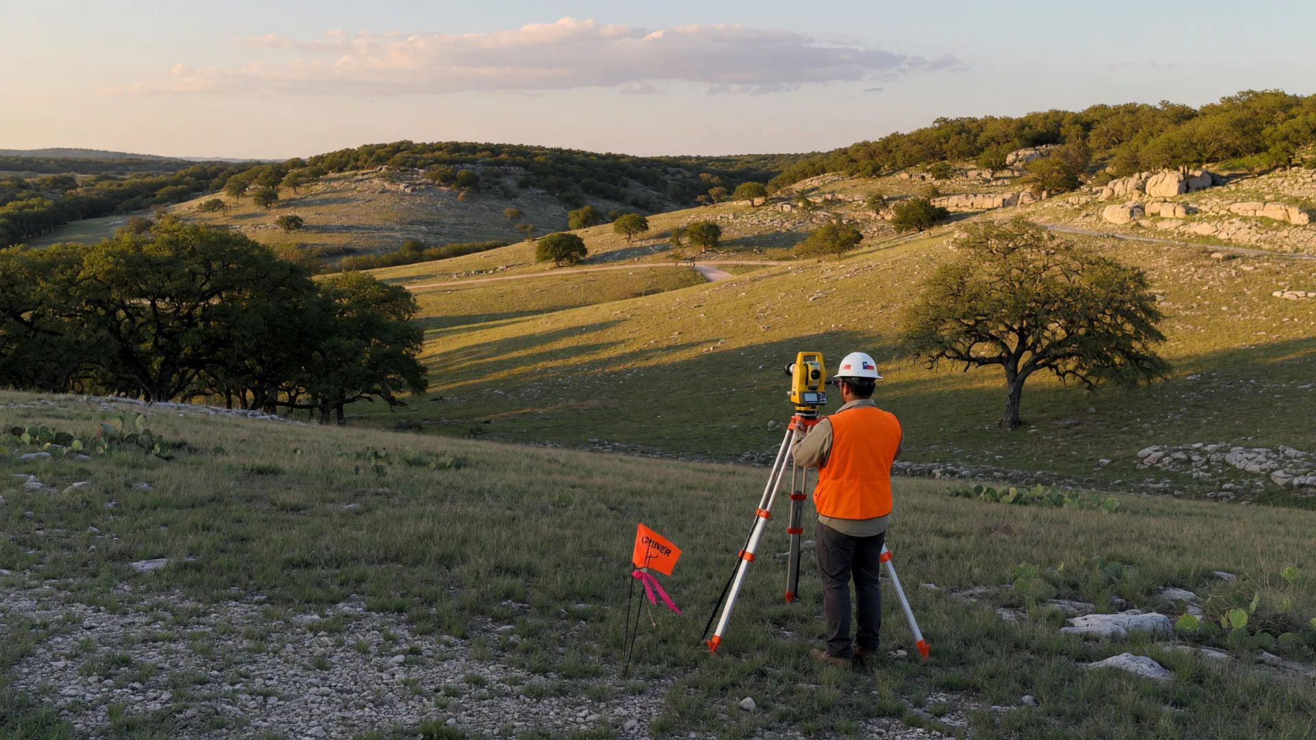
The Bottom Line
In Texas, professional land surveying must be performed by, or under the direct supervision of, a properly registered professional land surveyor, subject to the requirements of the Texas Surveying Practice Act and TBPELS rules. Before you pay anyone, rely on a boundary shown in a survey or legal description, or close on a property, verify the seal, the RPLS registration number, and the person standing behind the document.
WHAT SURVEY FRAUD—AND OTHER UNRELIABLE SURVEYING—CAN LOOK LIKE
These problems can overlap, but they are not legally equivalent. Intentional deception, forged credentials, or knowing misrepresentation may constitute fraud. Negligence, inadequate research, or failure to comply with professional surveying standards can produce an unreliable survey without necessarily constituting fraud.
- Unauthorized independent practice: Texas law generally prohibits a person from independently engaging in or offering professional surveying unless authorized under Chapter 1071 [7][24]. However, an employee who is not individually registered as an RPLS may perform surveying work under the direct supervision of an RPLS. The supervising RPLS remains professionally responsible for the final work. The warning sign is therefore not simply that a field employee lacks an RPLS registration; it is that professional surveying is being offered or issued without a properly registered professional surveyor taking responsibility for it.
- Forged or stolen seals: A document may contain a fictitious surveyor or improperly use the seal or registration information of a legitimate RPLS. TBPELS has specifically warned about online marketplace sellers delivering purportedly signed and sealed work bearing fraudulent professional credentials [1].
- Professional misconduct or negligent surveying—not necessarily fraud: A registered surveyor can still produce deficient work by failing to perform adequate boundary research, failing to properly relate the surveyed boundary to record evidence and monuments, or otherwise failing to meet Texas professional standards. These failures may constitute negligence, incompetence, misconduct, or a rules violation without proving intentional fraud. In an August 2025 disciplinary action, TBPELS imposed a two-year probated suspension and a $3,000 administrative penalty on an RPLS whose violations included inadequate research of the land-title records affecting the boundaries being surveyed [6].
- Non-survey products misrepresented as professional surveying: A satellite image, GIS map, Google Maps printout, sketch, or other drawing is not a substitute for professional boundary surveying merely because someone labels or markets it as a ‘survey.’ The critical question is whether the professional surveying was performed under the responsibility of an authorized RPLS and complies with applicable Texas standards.
In separate August 2025 cases, TBPELS issued cease-and-desist orders and $4,000 administrative penalties against entities that used representations of surveying seals without the registration holders’ permission while offering surveying services without being registered with the Board [6].
Another document-level warning sign is a mismatch between the survey and the legal description. The metes-and-bounds description, subdivision information, acreage, adjoining calls, parcel identity, or other recorded information should correspond with the property depicted on the survey. A mismatch can result from an error as well as fraud, so it should not automatically be labeled fraudulent, but it should be resolved with the RPLS and title company before the document is relied upon.
A genuine Texas survey is a professional product that protects a property right; a questionable one becomes a liability the moment a neighbor, lender, or title company questions it.
How to Verify a Texas Surveyor Before You Hire
Seven steps, in order. Work through them before you pay for the survey, rely on it for closing or another legal purpose, or use it in connection with a document to be recorded.
- Get the surveyor’s full legal name and Registered Professional Land Surveyor (RPLS) number before the first site visit.
- Verify the RPLS registration in the official TBPELS RPLS Roster and confirm that the status is “Registered.” TBPELS states that only registrations in “Registered” status are valid for active RPLS practice [2].
- Confirm that the final surveying work bears the RPLS's seal, signature (original or electronic as permitted by Texas rules), and date. The surveyor's name and registration number should agree with the TBPELS roster. Image quality alone does not establish whether a seal is genuine. If the seal, signature, name, number, or document appears altered or inconsistent, independently contact the RPLS or surveying firm and confirm that the surveyor actually prepared or supervised the work [1][2][24].
- Verify the RPLS in the official RPLS Roster and, when a private surveying firm or business is offering professional surveying services to the public, verify the firm separately in the TBPELS Surveying Firm Roster. Only firm registrations in “Registered” status are valid for surveying practice. Governmental entities are treated differently under the Board’s firm-registration rules [2][3].
- Independently confirm the survey with the surveyor. A stolen seal can display the name and registration number of a completely legitimate RPLS, so a successful roster search does not prove that the document came from that surveyor. Obtain the surveyor or firm’s contact information independently, not from the questionable document or the person who supplied it, and ask whether the firm prepared the survey for that property [1].
- Compare the document to the property and title records. Verify that the street address if shown, legal description, lot/block or metes-and-bounds information, acreage, subdivision or recording references, adjoining tracts, survey date, and property depicted correspond to the deed and title commitment. A discrepancy does not prove fraud, but it should be resolved before closing.
- Confirm that the scope includes the on-the-ground investigation and measurements appropriate to the survey, and ask who will perform the fieldwork. Fieldwork may be performed by employees or a field crew under the RPLS's direct supervision; the RPLS remains professionally responsible for the final surveying work [24].
VERIFY THE DOCUMENT, NOT JUST THE REGISTRATION
A real RPLS number on a document does not prove that the document is real. A fraudster can copy the seal, name, signature, or registration number of a legitimate surveyor. When authenticity matters, independently obtain the RPLS or firm’s contact information and confirm that the firm prepared or supervised the survey for that property.
Need a good place to start? This site keeps a Land Surveyors resource page for the Boerne, Fair Oaks Ranch, and San Antonio area, with local surveyors you can call and ask the questions above.
What a Real Survey Includes
A legitimate Texas boundary survey is more than a drawing. Texas standards require professional boundary analysis supported by appropriate title-record research, physical evidence, measurements, monumentation, and a final work product issued under the responsibility of an RPLS [24]. Depending on the scope and property, the work will generally involve:
- Fieldwork locating physical evidence and occupation on the ground: fences, pins, walls, and monuments.
- Records research: deeds, prior surveys, easements, and subdivision plats [24].
- Ties to record boundaries and monumented lines, so the map connects to the recorded legal description.
- Setting, or leaving as found, an adequate quantity of stable and reasonably permanent monuments to represent or reference the property or boundary corners, with the survey markers shown and described on the survey drawing, description, or report [24].
- For a survey drawing, identification of the surveying firm and firm registration number, the responsible land surveyor’s name and required contact information, the surveyor’s official seal and permitted signature, and the date surveyed, as required by TBPELS rules [24].
- Measurements and reported areas produced with methods and precision appropriate to the surveying service being performed [24].
- A clear delineation of the relationship between record monuments and the boundaries surveyed, with appropriate record references. When normal monumentation is absent, the surveyor’s boundary opinion must be supported by appropriate physical evidence explained in the surveyor’s sketch or written report [24].
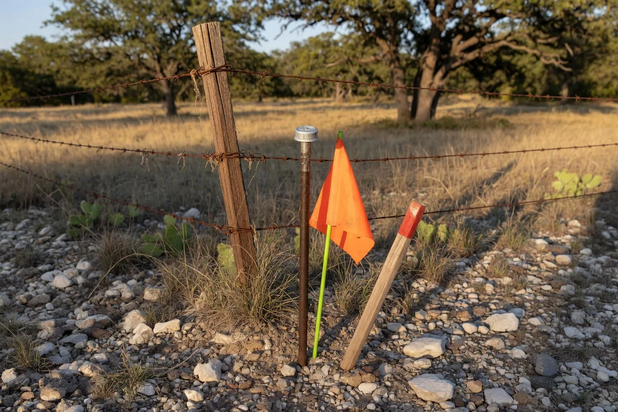
The physical corners matter most on raw land, where there are no structures to anchor your sense of the boundary; the difference between a vacant tract and an improved lot is covered in our guide to raw land vs. improved land in the Hill Country. And when a fence, driveway, or easement does not match the deed, the survey is where those facts surface; our easements, encroachments, and access guide goes deeper into what surveys reveal about boundary and access issues.
Typical Survey Price Ranges: Not a Test of Legitimacy
Typical reported survey costs in Texas
| Survey Type | Typical Range |
|---|---|
| Standard residential boundary survey | $350–$1,200 [20][21][22] |
| Title or mortgage survey | $450–$1,500 [20] |
| Rural Hill Country acreage | roughly $1,000–$5,000+ [22] |
| Topographic survey | $600–$3,000 [20] |
| ALTA/NSPS land title survey | $1,500–$5,000+ [20] |
These figures are published market examples, not rates established by Texas law or TBPELS. Survey fees can vary substantially with acreage, terrain, vegetation, access, availability of reliable monuments, quality of existing records, travel, requested deliverables, title issues, and the complexity of retracing the boundary. Price by itself cannot establish whether a survey is legitimate [20][21][22].
A price dramatically below local quotes deserves scrutiny if the provider represents the product as a professional boundary survey. The more important questions are whether the RPLS and firm are properly registered, whether the work complies with Texas surveying standards, whether appropriate records and field investigation are performed, and whether the named RPLS confirms responsibility for the final work.
Texas does not impose a blanket requirement that every purchase obtain a new survey, though a lender or title company may require one; if you are buying, ask for the survey before closing [12].
The survey is one line item in the full carrying-cost picture: see our guide to the real cost of owning acreage, and for the development expenses that come right after a survey, the land-clearing, oak wilt, caliche, and building-cost guide.
Existing Surveys, T-47/T-47.1, and Title Coverage
One practical money-saver: an existing survey may sometimes be accepted instead of requiring a new one. Texas title rules give a title company discretion to accept an existing real-property survey for area-and-boundary coverage regardless of the survey’s age or the identity of the person for whom it was originally prepared, provided the company finds the survey acceptable and it covers the same land. For residential real property, the seller may provide a T-47 Residential Real Property Affidavit or a T-47.1 Residential Real Property Declaration; unlike the T-47 affidavit, the T-47.1 does not require notarization. The title company or lender can still require a new survey if the existing one is unacceptable or circumstances have changed. A T-47 or T-47.1 verifies information concerning an existing survey; neither form is itself a survey [10][11][12].
Before relying on an older survey, ask:
- Does it depict exactly the same land being conveyed?
- Have fences, structures, driveways, additions, easements, or other improvements changed?
- Has the property been divided, replatted, conveyed in part, or otherwise legally changed?
- Does the title company accept the survey?
- Does the lender accept it, if financing is involved?
- Do the T-47 or T-47.1 representations accurately describe what has changed since the survey was prepared?
THE TITLE-INSURANCE ISSUE: Texas Owner’s Policies and Loan Policies ordinarily contain an exception concerning area-and-boundary matters. Under Texas Department of Insurance Procedural Rule P-2, a title company that finds the additional risk insurable may amend that exception to delete the general area-and-boundary language while retaining ‘shortages in area,’ subject to any specific exceptions the company determines are appropriate. The company may accept an existing survey even if it is older or was prepared for someone else, provided the company finds the survey acceptable and it covers the same land [10].
For residential real property, an accepted existing survey may be accompanied by a T-47 Residential Real Property Affidavit or T-47.1 Residential Real Property Declaration. A forged or altered survey should not be relied upon as survey evidence. If authenticity is questioned, stop the transaction and have the title company and the RPLS independently verify the document before closing.
The precise effect on title coverage depends on the policy, commitment, survey evidence, specific exceptions, underwriting decision, and facts of the transaction.
Red Flags: A Bookmark Checklist
Bookmark this list. Any one of these signs warrants additional verification. Multiple unresolved warning signs are reason to stop the transaction until the surveyor, firm, document, and, when applicable, the seller’s identity have been independently verified.
- Price far below the normal range in the table above
- No Texas RPLS registration number on the seal
- The name cannot be found in the TBPELS roster
- The “survey” was delivered as a satellite image or Google Maps printout
- No on-the-ground field investigation was performed by the surveyor or the surveyor’s field personnel, and the provider cannot explain what physical boundary evidence was examined.
- The provider will not give you a verifiable legal business name, Texas surveying-firm registration number, written scope of work, or reliable contact information.
- The provider pressures you to bypass normal title, lender, or professional verification, or discourages you from having the survey reviewed or authenticated.
- The provider uses unusual language denying authorship or professional responsibility for a document being represented to you as final professional surveying work.
Related but Different: Seller Impersonation, Deed Fraud and Property Alerts
A forged survey, a negligently prepared survey, seller-impersonation fraud, and a forged deed are different problems and are handled through different channels. TBPELS regulates professional surveying and investigates surveying violations. County recording alerts concern documents filed in the public records. Seller impersonation, identity theft, forged deeds, and wire fraud may also involve law enforcement, the title company, the title insurer, and legal counsel. One scheme can involve more than one of these problems, but they should not be treated as interchangeable.
Vacant land deserves additional identity verification because an impostor may be able to pose as an owner without encountering anyone physically occupying the property. The FBI issued a specific warning about vacant-parcel owner impersonation in June 2026 [13].
Rural and vacant Hill Country land can fit that risk profile because the true owner may not live on the property and suspicious activity may be less visible. That does not mean every absentee owner, estate, or remote transaction is unusually vulnerable, nor does it establish that these groups are specifically targeted for fraudulent surveys. The practical lesson is simpler: when a transaction involves vacant land or an owner who will not appear in person, independently verify both the seller’s identity and any survey supplied with the transaction.
Owners managing inherited property remotely face additional logistical issues addressed in our Texas probate-property resources. Likewise, buyers purchasing Hill Country property from another state can review our relocation and acreage due-diligence guide.
FBI WARNING: VACANT LAND. In June 2026, the FBI’s Internet Crime Complaint Center warned about criminals impersonating vacant-parcel owners. The FBI describes the use of fake identification, newly created email addresses, internet-based phone numbers, real-estate agents, and title companies to attempt unauthorized sales. For buyers of vacant land, the FBI recommends independently confirming the seller’s identity rather than relying solely on contact information supplied by the purported seller [13].
Survey fraud and deed fraud are related but distinct. A forged deed or other fraudulent recorded instrument can create an apparent ownership dispute or cloud on title. A forged or altered survey can create serious boundary and title problems if it is relied upon in a transaction or used in connection with a recorded instrument, but the survey itself does not create a lien merely because it exists.
A related seller-impersonation scheme has appeared locally as well. KSAT reported attempts involving fake sellers of vacant land in Helotes. That example concerns fraudulent sellers rather than fraudulent surveying, but it illustrates why vacant-land transactions deserve enhanced identity and document verification [19].
Warning signs of parcel-owner impersonation identified by the FBI include:
- The purported seller communicates only by email, text, or internet-based telephone service and refuses to meet in person.
- The seller pressures the parties to close unusually quickly or offers the property below market value to accelerate the transaction.
- The seller demonstrates limited knowledge of the property, lacks ordinary property documents such as survey or tax information, or provides inconsistent information.
- The seller requests sale proceeds through an international wire, an account in another person’s name, or an account in a location that has no apparent connection to the property.
- Deeds or other transaction documents contain unusual notarizations or other documentation that warrants independent verification [13].
County Property-Record Alerts
One useful free detection tool is a recorded-document alert, and if you own property in the Hill Country, you likely have more than one option. Bexar County property owners can sign up for the free Vanguard Property Alert, run by the Bexar County Clerk, at bexar.tx.publicsearch.us/property-alert [15][16]. Kendall County offers its own free GovOS Property Alert at kendall.tx.publicsearch.us/property-alert [17], and Comal County residents can sign up at propertyfraudalert.com/TXComal [18]. Each system emails you when a document is recorded against your property or your name. If you own in Bandera or another Hill Country county, contact the county clerk directly to determine whether a property-alert or recording-notification service is currently available.
Important limitation: these systems are notification tools, not title locks. They generally alert an enrolled owner after a matching document has been recorded or indexed. They do not determine whether a document is genuine, prevent an attempted recording, guarantee that fraud will be stopped, or authenticate a private survey that was never recorded.
What to Do If Something Appears Fraudulent
Where you report the problem depends on what appears to be wrong. Suspected unregistered surveying, misuse of an RPLS seal, or professional surveying misconduct belongs with TBPELS. A questionable recorded deed should also involve the county clerk, title company/title insurer, and legal counsel. Identity theft, seller impersonation, or internet/wire fraud may also warrant law-enforcement and IC3 reporting.
- Do not use the suspect document for closing, recording, or any legal purpose. Stop and get advice first.
- If the problem involves suspected unregistered surveying, misuse of a surveyor’s seal, a questionable professional survey, or professional surveying misconduct, file a complaint with TBPELS and provide the supporting document and evidence [4][5].
- If a questionable deed or other instrument has been or may have been recorded, contact the appropriate county clerk and review the county’s official records. Enroll in the county’s property-alert system if one is available [15].
- Check the named notary. The Texas Secretary of State’s Notary Public Search can help determine whether the named Texas notary holds a commission. A valid commission does not prove that the notary actually performed or authorized the notarization shown on a document. If the acknowledgment itself appears fraudulent, bring it to the title company, attorney, and appropriate authorities rather than treating a successful notary search as authentication [14].
- If a forged deed was recorded against your property, talk to a real-estate attorney about clearing title, and contact your title insurer if you have a policy [16].
- Know the legal stakes: unauthorized professional surveying or offering professional surveying in violation of Chapter 1071 can result in regulatory or other penalties [7]; TBPELS may discipline registration holders as authorized by the Surveying Act and Board rules [6][24]; and forgery committed with the required intent may constitute an offense under Texas Penal Code §32.21 [8].
- If you believe a survey contains a professional error, act promptly. Texas Civil Practice and Remedies Code §16.011 generally requires a suit for damages arising from an error in a survey to be brought no later than 10 years after the survey is completed. If a claimant presents a written claim for damages to the surveyor during that 10-year period, the statute provides an extension for two years from the date the claim is presented. Other statutes of limitation can apply depending on the legal theory and facts. Because limitation and repose rules are highly fact-specific, anyone who discovers a potentially damaging survey error should consult a Texas real-estate attorney promptly [9].
- If the suspected scheme involves seller impersonation, fraudulent identification, forged ownership documents, internet communications, or attempted wire fraud, preserve the emails, text messages, telephone numbers, identification documents, contracts, wire instructions, and other evidence. Report internet-enabled fraud to the FBI’s Internet Crime Complaint Center (IC3) and contact appropriate local law enforcement. If money has just been wired fraudulently, immediately contact the sending financial institution as well [13].
Questions to Ask Before You Hire a Surveyor
Ask these questions in writing, and keep the answers.
- What is your full name and RPLS registration number?
- Will you personally supervise the fieldwork on this property?
- What records will you research beyond the current deed?
- Will the final work be signed, sealed, and dated as required, and how will the boundary corners be monumented or referenced?
- What is the scope: boundary only, title or mortgage survey, or an ALTA/NSPS survey?
- How will you handle discrepancies between found monuments, fences, and the recorded deed?
- What does the fee include, and what is the timeline?
- Will you flag encroachments and contested lines in writing?
Frequently Asked Questions
Is a survey legally required when I buy property in Texas?
Texas does not impose a blanket requirement that every real-estate purchase obtain a new survey. The contract, lender, title company, property type, existing survey, and requested title coverage can determine whether a survey is needed or whether an existing survey will be accepted. Current TREC contracts also contemplate circumstances in which an existing survey is furnished or a buyer may obtain a new one [12].
Can I get a reliable survey online for a cheap price?
An online transaction is not automatically illegitimate, but an online-only product cannot substitute for the records research, boundary analysis, field investigation, measurements, monumentation, and professional supervision required for a legitimate boundary survey. Fieldwork may be performed by employees working under an RPLS's direct supervision [24]. TBPELS has specifically warned that some online marketplace offerings have involved unregistered providers and fraudulent or stolen seals [1][7]. Verify the RPLS and firm independently before relying on the document.
How do I verify a Texas surveyor’s registration?
Use the official TBPELS RPLS Roster, compare the surveyor’s name and RPLS number with the document, and confirm that the registration status is “Registered.” TBPELS states that only registrations in “Registered” status are valid for active RPLS practice. A valid registration does not by itself authenticate a particular survey, so independently contact the surveyor or firm if the document’s authenticity is in question [2].
What is the difference between a boundary survey and an ALTA/NSPS survey?
A boundary survey determines or retraces the property boundary under applicable Texas surveying standards. An ALTA/NSPS Land Title Survey is a boundary survey prepared to nationally recognized ALTA/NSPS standards for title-related due diligence. It is commonly used in commercial, institutional, financing, and other complex transactions. The required information can be expanded through specifically selected optional Table A items, so the exact scope depends on what the parties request. The current 2026 ALTA/NSPS Minimum Standard Detail Requirements became effective February 23, 2026 and superseded earlier versions [23].
Which properties deserve extra attention for seller-impersonation fraud?
The FBI’s June 2026 warning specifically addresses vacant property parcels, where an impostor may be able to pose as an owner without encountering anyone physically occupying the property [13]. That does not establish that every vacant or remotely owned property is likely to be targeted. Owners of vacant property can reduce the detection gap by reviewing county records periodically and enrolling in a recording-alert service where one is available.
Is there a free way to monitor my property?
Yes, if your county offers it. Bexar County’s Vanguard Property Alert sends email alerts when a document is recorded against your property or name, and it is free [15][16].
What do I do if I think I have already been scammed?
First identify what appears to have been falsified. If the issue involves surveying work, an RPLS seal, or an unregistered surveying provider, preserve the evidence and report the matter to TBPELS [4]. If it involves seller impersonation, a forged deed, identity theft, or internet-enabled fraud, contact the title company or title insurer, the appropriate county clerk, a Texas real-estate attorney, appropriate law enforcement, and IC3 as applicable [13][15]. If money was recently sent by fraudulent wire instructions, contact the sending financial institution immediately.
Sources
- TBPELS, Notice to the Public: Fraudulent Engineering & Surveying Work from Online Marketplaces. The board’s warning about fraudulent, stolen, or fictitious professional seals in work sold online. pels.texas.gov
- TBPELS, RPLS Roster. Official Registered Professional Land Surveyor registration verification; only registrations in “Registered” status are valid for active RPLS practice. pels.texas.gov/roster/rplssearch.html
- TBPELS, Surveying Firm Roster. Searchable roster of surveying firms registered with the Board; only firms with registrations in “Registered” status are valid for offering professional surveying services to the public. pels.texas.gov/roster/lsfirmsearch.html
- TBPELS, How to File a Complaint. pels.texas.gov/complaint.htm
- TBPELS, Contact Information. pels.texas.gov/contact.htm
- TBPELS, “August 14, 2025 Board Meeting Disciplinary & Administrative Actions.” pels.texas.gov/downloads/enf/da/2025/da-08-14-2025.pdf
- Texas Occupations Code, Chapter 1071 (Land Surveyors). Texas Legislature Online. statutes.capitol.texas.gov/Docs/OC/htm/OC.1071.htm
- Texas Penal Code, Section 32.21 (Forgery). Texas Legislature Online. statutes.capitol.texas.gov/Docs/PE/htm/PE.32.htm
- Texas Civil Practice and Remedies Code, Section 16.011 (Surveyors). Texas Legislature Online. statutes.capitol.texas.gov/Docs/CP/htm/CP.16.htm
- Texas Department of Insurance, Basic Manual of Title Insurance, Section IV (Area and Boundary Coverage), Procedural Rule P-2. Title-insurance survey requirements, including acceptance of existing surveys with T-47/T-47.1. tdi.texas.gov/title/titlem4a.html
- Texas Department of Insurance, Form T-47.1, Residential Real Property Declaration in Lieu of Affidavit. tdi.texas.gov/title/documents/form-t-47-1.pdf
- Texas Real Estate Commission, Current Contracts and Forms, including One to Four Family Residential Contract (Resale), Form 20-19, and Farm and Ranch Contract, Form 25-17, effective July 1, 2026. trec.texas.gov/agency-information/contracts
- FBI Internet Crime Complaint Center (IC3), Public Service Announcement, “Protect Your Property from Illegal Sales Through Parcel Owner Impersonation” (June 16, 2026). ic3.gov/PSA/2026/PSA260616
- Texas Secretary of State, Notary Public Search. sos.state.tx.us/statdoc/notary-public.shtml
- Bexar County Clerk, Vanguard Property Alert. bexar.tx.publicsearch.us
- Bexar County Clerk, A Message about Property Fraud from your Bexar County Clerk. bexar.org
- Kendall County Clerk, Real Property Fraud Alert Service. kendallcountytx.gov/documentcenter/view/2378/property-fraud-alert-pdf
- Comal County Clerk, Property Fraud Alert System. Official Comal County Clerk page listing the Property Fraud Alert System available to county property owners. co.comal.tx.us/cc.htm
- KSAT, “Fake land sellers target Helotes again” (April 18, 2023). Local example of seller impersonation involving vacant land. ksat.com
- Alliance Land Surveyors, “How Much Does a Land Survey Cost in San Antonio?” Published market example, not an official rate. alliancelandsurveyors.com
- Neuhaus Real Estate, “Easements, Boundaries & Land Surveys in Texas.” Published market example, not an official rate. neuhausre.com
- FindLandSurveyor, “Boundary Survey Cost in Texas.” Published market example, not an official rate. findlandsurveyor.com
- American Land Title Association and National Society of Professional Surveyors, 2026 Minimum Standard Detail Requirements for ALTA/NSPS Land Title Surveys, effective February 23, 2026. nsps.us.com
- TBPELS, Texas Engineering and Land Surveying Practice Acts and Rules, current edition effective June 18, 2026. See particularly 22 Tex. Admin. Code §§138.33, 138.35, 138.77, 138.83, 138.85, 138.87 and 138.91. pels.texas.gov/lawrules
Last verified: September 8, 2026
Fees, deadlines, county program sign-ups, and registration status change; confirm each time-sensitive detail with the issuing office or agency before you rely on it.
Published: September 8, 2026
Updated September 8, 2026