
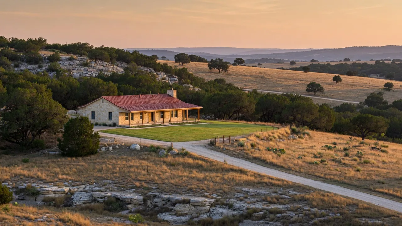
Wildfire is a recurring operational risk for homes in the Texas Hill Country, and for buyers and sellers in Boerne, Fair Oaks Ranch, and the surrounding counties it is also a transaction issue. The region sits at the meeting point of long drought cycles, volatile native fuels, and rapid development pushing new homes into the wildland-urban interface, the zone where Texas wildfires most often damage property [1][2]. Most structure loss is driven by embers and radiant heat within about 100 feet of the home, which means the people who own a property, and the people evaluating one, can measure and change most of the variables that decide whether a house ignites [9][10]. This guide covers how real the risk is in Kendall, Comal, Bandera, and Bexar counties, the defensible space zones that matter, the home hardening choices that block embers, and the insurance and disclosure steps buyers and sellers should check before a transaction closes.
A note on sourcing before the details. County burn bans, insurance rules, and disclosure requirements change, and the fire risk maps are updated as new data arrives. The figures below were checked against the public sources cited in this article in September 2026, and the full source list appears at the end so you can verify them yourself.
How real is the wildfire risk around Boerne and Fair Oaks Ranch?
The short answer: real enough that the counties around Boerne treat wildfire as a core public safety planning problem. Kendall County's Community Wildfire Protection Plan, prepared with the Texas A&M Forest Service and the region's fire departments, reports that 94 percent of the county's growth is occurring in the wildland-urban interface, the zone where wildfire risk is concentrated [1]. The Texas A&M Forest Service warned in January 2026 that above-normal grass growth from the 2025 growing season would raise dormant-season wildfire risk across the state, including the Hill Country [3].
The day-to-day evidence comes from the counties themselves. Comal County has had a burn ban in effect since August 20, 2026 [4]. Bandera County issued its own ban in August 2026 amid dry conditions [5]. Bexar County extended its burn ban in October 2025 while officials described area wildfire risk as high after a multi-year drought left vegetation dry and brittle [6]. Kendall County re-imposed bans during the 2023 heat and drought [1]. None of this means a home near Boerne will burn. It means the preconditions for fast-moving grass and brush fires exist in this area most years, and a windy, dry day is the difference between a controlled situation and an uncontrolled one.
Wildfire risk signals around the Hill Country
| County | Key signal | What buyers and sellers should know |
|---|---|---|
| Kendall (Boerne) | 94% of growth in the wildland-urban interface per the county CWPP [1] | Most new subdivisions sit in or next to native juniper and oak woodland |
| Comal | Burn ban in effect since August 20, 2026 [4] | Drought-driven bans are a seasonal norm |
| Bandera | Burn ban issued August 2026 [5] | Ranch country with heavy juniper fuel loads on steep terrain |
| Bexar (northwest, including portions of Fair Oaks Ranch) | Burn ban extended October 2025; officials described area wildfire risk as high [6] | 262-acre Silver Mountain fire in August 2025 started from an escaped controlled burn [7] |
Burn ban status changes weekly. Check the current county order or the Texas A&M Forest Service fire danger map before relying on any date in this table [3][4][5][6].
For a sense of what a worst-case fire looks like in this region, the benchmark is the 2011 Bastrop County Complex fire east of Austin, the most destructive wildfire in Texas history. It burned roughly 34,000 acres, destroyed approximately 1,700 homes, and killed two people, and it was ignited when wind-snapped trees hit power lines during extreme drought [8]. Fires at that scale do not stop at subdivision lines, and the Hill Country's juniper and oak fuel load can carry a fire the same way when conditions align.
Why Hill Country properties can burn: fuel, terrain, and embers
A home does not have to be deep in the woods to be at risk. Three elements decide how fast and how hot a fire reaches a structure, and all three are visible on a drive through Kendall or Comal County [1][2]:
- Ashe juniper, known locally as cedar. The region's most common woody fuel carries volatile oils that burn hot and fast, and dense cedar brakes on slopes can produce crown-fire conditions. Mature juniper also drops ladder fuels that can carry a ground fire up into oak canopies [1].
- Live oak and native grass. Live oak litter and cured grass become a continuous fuel bed after summer heat or a dry winter. Wet growing seasons, like 2025, produce more grass, which then dries into more fuel [3].
- Terrain and wind. Fire moves faster uphill, and the Hill Country's limestone ridges, canyons, and draws funnel wind in ways that accelerate spread. Red-flag days, when humidity is low and wind is high, are when the region's largest fires have started [1][6].
Most homes are not destroyed by the main flame front. They are destroyed by embers. Wind carries burning material ahead of the fire, sometimes more than a mile, and an ember landing in a gutter full of leaves, a woodpile against the wall, an open vent, or a bed of juniper needles next to the foundation can ignite the house long before the main fire arrives [10]. That is why the first five feet around the home matter more than anything else on the property, and why the standard advice is organized as zones measured outward from the house [9][10].
The home ignition zone: three zones you can actually manage
The National Fire Protection Association's Firewise program organizes wildfire preparation around the home ignition zone, roughly 100 feet from the structure, split into three bands [9][10][11]. Terminology differs by source: the NFPA pocket guide labels the same bands Zone 1, 2, and 3, while California and most local fire districts use Zone 0, 1, and 2. The distances are what matter, not the labels.
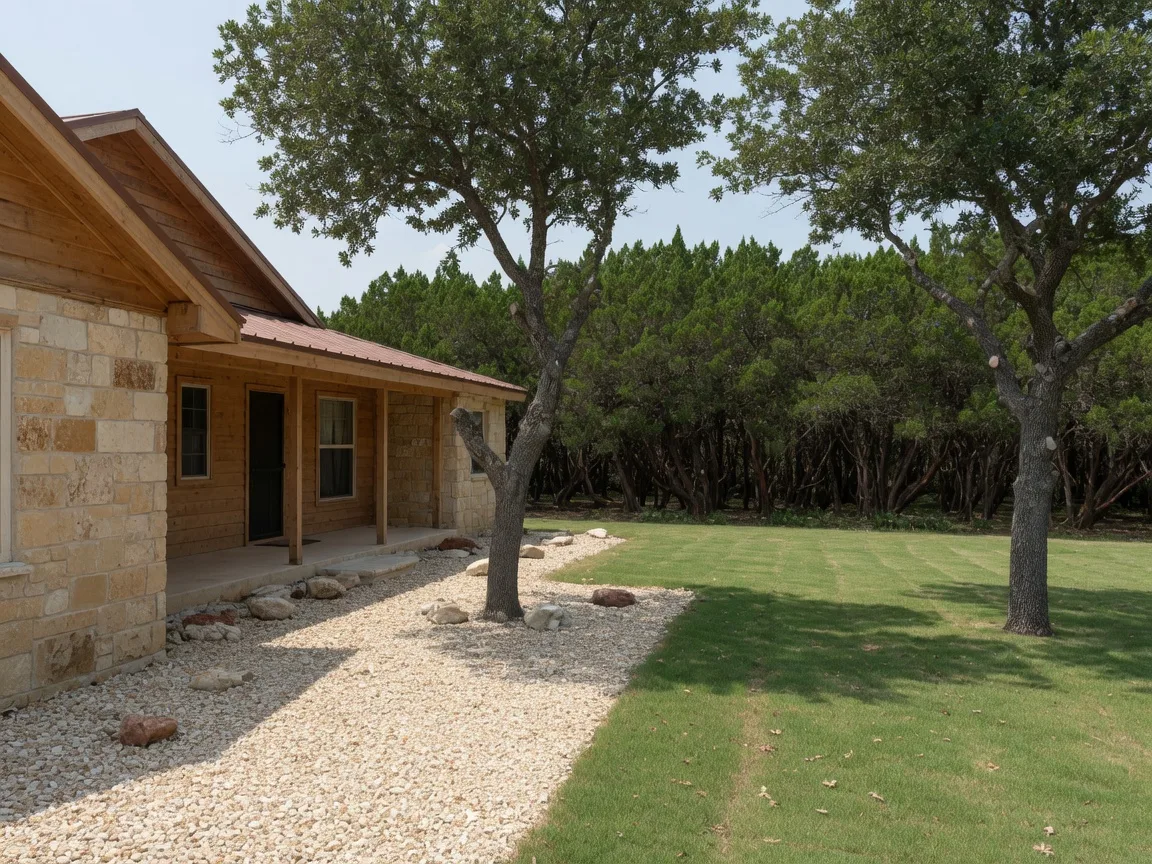
Zone 0, the immediate zone, 0 to 5 feet from the house. This is the most ember-vulnerable five feet on the property, and it should be fully noncombustible. No mulch, no woodpiles, no dead vegetation, and no combustible patio furniture or deck storage under the eaves. Rock, gravel, stone, or pavers are the ground cover of choice, and plants should be hardscape or widely separated noncombustible specimens [10][11].
Zone 1, the intermediate zone, 5 to 30 feet. Grass should be kept short and green, dead plants and debris removed, shrubs spaced and pruned, and tree canopies lifted so there is no continuous ladder from ground fuels to the crown. The goal here is a lean, clean, and green landscape that starves a ground fire of fuel [9][11].
Zone 2, the extended zone, 30 to 100 feet. This band reduces the intensity of an approaching fire. Thinning trees, keeping horizontal crown spacing between trees, and removing accumulated dead wood keep a crown fire on the ground where it is easier to stop [9][11]. On steep slopes, or in wind-exposed positions, the effective buffer may need to be larger than 100 feet, and on smaller lots the zone simply extends to the property line, which means coordinating with neighbors [9].
The three defensible space zones at a glance
| Zone | Distance from the home | What belongs there |
|---|---|---|
| Immediate (Zone 0) | 0 to 5 feet | Rock, gravel, stone, or pavers only. No mulch, plants, woodpiles, or combustible furniture touching the house. |
| Intermediate (Zone 1) | 5 to 30 feet | Lean, clean, and green landscaping: short grass, pruned and spaced shrubs, limbs lifted, no ladder fuels. |
| Extended (Zone 2) | 30 to 100 feet | Thinned trees with crown spacing, dead wood removed, ground fuels reduced so fire stays low. Larger on slopes. |
Sources: NFPA Community Wildfire Mitigation Pocket Guide; NFPA Firewise fact sheets; Fire Safe Marin. Some agencies number these zones 1, 2, and 3 with identical distances [9][10][11].
Hardening the house itself: the ember entry points
Defensible space slows the fire's approach. Home hardening stops embers from getting in once it arrives. The items below are the ones fire protection engineers check first, and each maps to a specific ember entry point [9][10][11]:
- Roof. A Class A fire-rated covering, which includes most composition shingles, tile, and standing-seam metal, is the single most important material choice. Wood shake and shingle roofs are the highest-risk options and should be flagged by a buyer evaluating an older home [9].
- Vents. Soffit, gable, attic, and crawlspace vents are open doors for wind-blown embers. Ember- and flame-resistant vent designs use fine metal mesh, commonly 1/8-inch or smaller, and California's standard for new construction is 1/16-inch mesh [11]. Open eaves should be boxed in.
- Gutters. A gutter full of dry leaves can ignite the fascia and the roof edge. Keep gutters clear and use noncombustible gutter guards where practical [9].
- First five feet of wall. Noncombustible siding such as fiber-cement, stucco, or metal in the immediate zone removes an ignitable vertical surface next to the fire's entry path [10][11].
- Windows and skylights. Tempered or dual-pane glass holds up better against radiant heat, and embers can break single-pane glass. Multi-pane windows are also the standard on most newer Hill Country construction [9][11].
- Decks and fences. Combustible decks and attached fences act as wicks into the structure. Noncombustible decking, a stone and gravel buffer under a deck, and a metal or masonry section where a fence meets the house close that path [10][11].
For acreage owners, there is one more layer that matters before the house: fuel break maintenance on the property itself. Cedar control, oak wilt management, and cleared road frontage are recurring costs of Hill Country ownership, and they do double duty as wildfire mitigation. The site's guide to land clearing, oak wilt, and caliche blasting costs and the oak wilt guide cover what clearing and tree work actually runs in this market.
Wildfire and the transaction: insurance, disclosure, and closing
Wildfire risk becomes a transaction issue in three places: insurance availability, seller disclosure, and the buyer's due diligence. Each has its own rules, and each is checkable in advance.
Insurance. Standard Texas homeowners policies cover fire, including wildfire, as a named peril, so there is no separate wildfire policy to buy the way flood insurance is sold separately. The real questions are availability and price. In wildland-urban interface areas, insurers evaluate roof material, distance to dense vegetation, local fire protection class, and claims history, and homes with older roofs or heavy brush close to the structure are the ones that draw higher premiums, nonrenewals, or denials [13]. Texas has added two protections for homeowners. House Bill 2067, effective with rules beginning January 1, 2026, requires insurers to give a written explanation when they decline, cancel, or nonrenew a policy, and a 2026 Texas Department of Insurance bulletin bars insurers from counting certain natural catastrophe and weather claims toward the three-claims-in-three-years threshold used to nonrenew [14][15]. When standard-market coverage is unavailable, the Texas FAIR Plan, the state's insurer of last resort, writes fire-inclusive named-peril policies at a premium that is typically well above the standard market and with narrower coverage [13][16]. The site's property insurance guide covers the Texas deductible structure and what the region actually pays.
Disclosure. Texas does not require a wildfire-risk or wildfire-hazard-zone disclosure comparable to states like California, and the TREC Seller's Disclosure Notice contains no specific wildfire question [17]. What the law does require is broader: Texas Property Code Section 5.008 requires sellers to disclose known material defects about the property's condition, and fire damage is a condition. A seller who knows the home was damaged by fire, or that a fire was the reason for a major repair, is expected to disclose the damage and the repairs, and records of those repairs are exactly the documents a buyer's team will ask for during the option period [17][18]. The practical version of this rule: keep the roof invoices, the insurance claims, and the contractor records, and answer the disclosure form honestly and completely.
Due diligence. For a buyer, the strongest protections are the inspection contingency, the option period, and the narrow question of whether the property can be insured at a reasonable rate. A standard home inspection will not grade the property's fire risk, so the buyer's own walk-around should cover the immediate zone, the roof material, the vents, and the distance from the structure to heavy vegetation [9]. A quote for homeowners insurance, before the offer is written, settles the cost question that otherwise shows up as a surprise at closing [13].
The buyer's checklist before you make an offer
Wildfire due diligence checklist for Hill Country buyers
| Check | Where to look | What to confirm |
|---|---|---|
| Wildfire risk rating | Texas Wildfire Risk Assessment Portal (TxWRAP) | The parcel's risk category and proximity to high-risk wildland [12] |
| County plan and current fire danger | County Community Wildfire Protection Plan; Texas A&M Fire Danger map | Burn ban status and the area's local risk assessment [1][3] |
| Fire protection resources | Local fire department or emergency services district | Response distance, whether the station is volunteer, hydrant access, and driveways rated for fire apparatus [2] |
| Insurance quotes | Two to three carriers before the offer | Availability, premium, and any roof-age or brush conditions [13] |
| Immediate zone condition | Walk the exterior of the home | Mulch, brush, woodpiles, and debris within 5 feet; plants touching the walls [10] |
| Roof and vent materials | Inspection and walk-around | Class A roof covering, vent mesh, enclosed eaves, gutter condition [9][11] |
| Prior fire and claims history | Seller disclosure; CLUE report on request during the option period | Any prior fire damage, repairs, or insurance claims on the property [17][18] |
Most of these checks are free and take minutes. The insurance quote and the CLUE report are the only items that require another party, and both fit inside a standard option period.
What sellers should do before listing
Wildfire preparation is also a listing condition in the Hill Country market. Buyers, and their insurers and inspectors, now walk the exterior of a property with fire in mind, and a neglected immediate zone reads the same way a worn roof does [9][13]. Before the photos are taken:
- Complete the immediate zone. Clear mulch, brush, and debris within 5 feet of the foundation, move woodpiles away from the walls, and make sure a mower can reach the property line on the brush side of the house [10].
- Address visible fuel. On acreage, cleared road frontage and a maintained band between the structure and dense cedar or oak growth are both safety measures and curb appeal [1][9].
- Assemble the records. Roof invoices, repair receipts, insurance claim history, and any tree or clearing work go in the same pre-listing folder as the survey and the well log. The site's property records checklist for sellers covers the full list.
- Answer the disclosure accurately. Fire damage, like any material defect, belongs on the TREC Seller's Disclosure Notice with the repairs documented [17][18].
Frequently asked questions
Do I need a separate wildfire insurance policy in Texas?
No. Fire, including wildfire, is a covered peril on a standard Texas homeowners policy [13]. The practical concern is availability and cost in higher-risk areas, not a separate purchase. Get quotes before you commit to a contract, and if the standard market declines you, the Texas FAIR Plan is the state's last-resort option [13][16].
Can an insurer nonrenew a policy after a fire-related claim?
Texas law now sets specific limits. Under the 2026 TDI bulletin, certain natural catastrophe and weather claims cannot be counted toward the three-claims-in-three-years threshold insurers use to nonrenew, and since January 1, 2026, insurers must provide a written explanation for a decline, cancellation, or nonrenewal under House Bill 2067 [14][15]. If a policy is not renewed, a complaint can be filed with the Texas Department of Insurance [13].
Does clearing cedar actually reduce fire risk?
Yes, when it is done as part of a complete fuel reduction program. Ashe juniper carries volatile oils and creates ladder fuels, so removing dense cedar stands and their litter reduces both flame intensity and ember generation [1][9]. Clearing is a recurring Hill Country ownership cost, and the site's land clearing cost guide breaks down what it runs per acre.
Do I have to disclose that the house previously caught fire?
Texas has no specific wildfire-risk disclosure question, but the general rule applies: known material defects, which include fire damage and the repairs made afterward, should be disclosed on the Seller's Disclosure Notice under Property Code Section 5.008, and the repair records should be provided to the buyer [17][18]. When in doubt, disclose and document.
The bottom line
Wildfire is part of the risk picture for Hill Country property, and it is one of the most manageable parts. The first five feet around the home and the material choices on the roof and vents do most of the work. The county data, the burn bans, and the recurring dry cycles say the risk is real around Boerne and Fair Oaks Ranch, and the insurance market now prices it. For buyers, that means checking risk, quotes, and the exterior condition before the option period starts. For sellers, it means completing the immediate zone, keeping the records, and disclosing accurately. Neither side has to be a fire expert; both sides have to look, and the looking takes about 30 minutes on foot [9][10][13].
Sources
- Kendall County Community Wildfire Protection Plan (2023). Prepared with the Texas A&M Forest Service, the City of Boerne, and seven volunteer fire department chiefs; reports that 94 percent of the county's growth is occurring in the wildland-urban interface. co.kendall.tx.us
- Texas A&M Forest Service, Wildfire Risk. The agency's wildfire risk overview and the wildland-urban interface as the zone where most Texas wildfires occur. tfsweb.tamu.edu
- Texas A&M Forest Service, "Dry conditions and increased vegetation set stage for higher wildfire risk in Texas" (January 2026). The dormant-season risk warning driven by above-normal 2025 grass growth. tfsweb.tamu.edu
- BurnBanTexas, Comal County. Burn ban status; in effect since August 20, 2026. burnbantexas.com
- FOX San Antonio, "Bandera County issues burn ban as dry conditions raise wildfire risk" (August 2026). Bandera County's August 2026 burn ban. foxsanantonio.com
- Texas Public Radio, "Bexar commissioners extend burn ban; area wildfire risk is high" (October 2025). The October 2025 extension and officials' description of high area wildfire risk after drought. tpr.org
- KENS 5, "Bexar Co. fire marshal to push for countywide burn ban after flames scorch 262 acres" (August 2025). The 262-acre Silver Mountain fire, ignited by an escaped controlled burn. kens5.com
- Bastrop County Complex Fire, historical record. Acreage, structure loss, fatalities, and ignition circumstances of Texas' most destructive wildfire (2011). en.wikipedia.org
- NFPA, Community Wildfire Mitigation Pocket Guide. The home ignition zone concept and the three bands (0 to 5, 5 to 30, and 30 to 100 feet), plus roof, vent, deck, and fence hardening guidance. nfpa.org
- NFPA, Immediate (Noncombustible) Zone fact sheet. Why the 0 to 5 foot zone is the most ember-vulnerable and must be noncombustible. nfpa.org
- Fire Safe Marin, Defensible Space Zones. Zone 0, 1, and 2 distances and ember- and flame-resistant vent standards, including 1/16-inch mesh for California new construction. firesafemarin.org
- Texas Wildfire Risk Assessment Portal (TxWRAP). The official long-term wildfire risk mapping tool for Texas. texaswildfirerisk.com
- Texas Department of Insurance, "Was your home insurance canceled or not renewed?" What to do after a nonrenewal, the FAIR Plan as the market of last resort, and filing a complaint with TDI. tdi.texas.gov
- Texas Department of Insurance, Commissioner's Bulletin B-0006-26. Prohibited nonrenewal practices: certain natural catastrophe and weather claims cannot count toward the three-claims-in-three-years threshold. tdi.texas.gov
- Texas Department of Insurance, Commissioner's Bulletin B-0012-25 (House Bill 2067). The written-explanation requirement for declined, canceled, or nonrenewed policies, effective with rules beginning January 1, 2026. tdi.texas.gov
- CoverageCat, Texas FAIR Plan Association review. The state's insurer of last resort, fire-inclusive named-peril coverage, and the surge in applications as carriers restrict higher-risk areas. coveragecat.com
- TREC, Seller's Disclosure Notice (Form 55-1). The official form and its condition questions; no wildfire-risk question exists on the Texas form. trec.texas.gov
- Texas Property Code, Section 5.008, Seller's Disclosure of Property Condition. The statutory disclosure requirement and the material-defect standard that covers known fire damage. texas.public.law
The facts in this article were checked on September 22, 2026 against county wildfire protection plans, Texas A&M Forest Service and county burn-ban records, fire department reporting, NFPA and Firewise guidance, Texas Department of Insurance bulletins, and the Texas disclosure statutes. Burn bans, insurance rules, and risk maps change; confirm current conditions before relying on any figure.
Last verified: September 22, 2026
Published: September 22, 2026
Updated September 22, 2026